Superwalker XT25 maps
De ultieme kaarten voor wandelaars: ontdek de Super Walker XT25 Maps van Harvey Maps
 Wandelkaart Brecon Beacons West | Harvey Maps
Includes Pen y Fan, Foel Fraith, Fan Fawr and Fan Gyhirych. Detailed map for hillwalkers of the western part of the Brecon Beacons National Park at the popular scale …
 Wandelkaart Torridon | Harvey Maps
Een bijzonder handige kaart van dit gebied. Op waterafstotend papier met veel details. ncludes Slioch, Beinn Eighe, Liathach and Beinn Alligin. Detailed map for hillwalkers of the Torridon Hills …
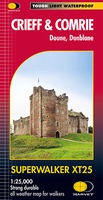
 Wandelkaart Crieff & Comrie, Doune, Dunblane | Harvey Maps
Map covers the Munro, Ben Chonzie, popular Glen Artney, as well as the Braes of Doune and Doune Castle, which has featured in various film and television shows, such as …
 Wandelkaart An Teallach | Harvey Maps
 Wandelkaart Fannichs Seana Bhraigh & Ben Wyvis | Harvey Maps
Detailed map for hillwalkers of the Fannichs ridge at the popular 1:25,000 scale. This is an area located to the south of Ullapool and to the west of Dingwall. Includes …
 Wandelkaart Skye The Cuillin | Harvey Maps
New Revised Edition and Format. More than a map, an essential piece of equipment this new generation HARVEY Superwalker is designed to be the most practical tool for navigation outdoors. …
 Wandelkaart Peak District Central | Harvey Maps
New Superwalker XT25 of the Peak District Revised and re-designed. It's got everything! Genuine original HARVEY mapping at 1:25,000. Ideal for walking. Clear, easy to read. Easy to re-fold. Opens …
 Wandelkaart Ben Alder | Harvey Maps
Superwalker is designed to be the most practical tool for navigation outdoors. The Superwalker XT25 is based on original HARVEY mapping with all the information a walker would expect on …
 Wandelkaart Yorkshire Dales Zuid-West | Harvey Maps
The Yorkshire Dales National Park on just 4 sheets. Yorkshire Dales South West: The coverage of this map includes Yorkshire Three Peaks, Whernside, Ingleborough and Pen-y-Ghent. Genuine original HARVEY mapping …
 Wandelkaart Pitlochry Loch Tummel & Blair Atholl | Harvey Maps
Detailed map for hillwalkers of Pitlochry, Loch Tummel and Blair Atholl at the popular 1:25,000 scale. Includes Ben Vrackie, Beinn a’ Ghlo and Pass of Killiecrankie. Shows Aberfeldy in …
 Wandelkaart Ben Lawers & Schiehallion | Harvey Maps
Harvey Maps for hillwalkers showing the hills from Loch Tay to Glen Lyon. This detailed walking map includes Ben Lawers and the Tarmachan Ridge. The Superwalker XT25 is based on …
 Wandelkaart Pentland Hills | Harvey Maps
The whole of the Pentlands on one side of one sheet. More than a map, an essential piece of equipment this new generation HARVEY Superwalker is designed to be the …
 Wandelkaart Loch Lomond & The Trossachs | Harvey Maps
Detailed Superwalker map for walkers of Loch Lomond & the Trossachs National Park at 1:25,000 scale. Includes Scotland?s most southerly Munro, Ben Lomond and an inset map for access to …
 Wandelkaart Dingle Peninsula | Harvey Maps
The whole of the Dingle Peninsula on one lightweight, waterproof map at the popular 1:30,000 scale. Includes Mount Brandon and the entire Brandon Group of mountains in the west …
Laatste reviews

Blij dat De Zwerver deze perfecte, franstalige IGN gidsen aanbiedt en dan óók met een woordenlijst erbij gevoegd. De voorbereiding kan beginnen na een vlotte …
★★★★★ door Lie van Schelven 06 januari 2025 | Heeft dit artikel gekocht
Voor een paar dagen Leipzig een prima reisgids. Het deel voor Dresden is aanmerkelijk groter maar was niet hinderlijk.
★★★★★ door J.A. Pazie 06 januari 2025 | Heeft dit artikel gekocht
Op reis in Botswana is deze kaart onmisbaar en vreselijk nuttig. Handig met tankstations. Snel thuisbezorgd.
★★★★★ door henk heeringa 06 januari 2025 | Heeft dit artikel gekocht
Zeer tevreden.
★★★★★ door R. Ahlers 06 januari 2025 | Heeft dit artikel gekocht

