Kaarten - Schotland
 Wandelkaart Arrochar Alps | Harvey Maps
Includes Beinn Ime, Ben Vorlich and the Cobbler (Ben Arthur). Detailed map for hillwalkers of the western part of the Loch Lomond and Trossachs National Park at the popular scale …
 Wandelkaart Arrochar Alps | Harvey Maps
Covers a large area yet is handily compact. Pocket perfect! Includes Beinn Ime, Ben Vorlich and the Cobbler (Ben Arthur). Detailed map for hillwalkers of the western part …
 Wandelkaart Ben Lawers & Schiehallion | Harvey Maps
40 years’ experience have gone into HARVEY’s most creative new series. Slim and light, the Ultramap covers a large area and yet is handily compact. Pocket perfect! Includes Ben …
 Wandelkaart Cairn Gorm & Ben Avon | Harvey Maps
40 years’ experience have gone into HARVEY’s most creative new series. Slim and light, the Ultramap covers a large area and yet is handily compact. Pocket perfect! Includes Cairn …
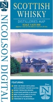 Wegenkaart - landkaart Scottish Whisky Distilleries Map | Schotse whiskystokerijen | Nicolson
Our brand new and up to date whisky map shows over 150 distilleries on our exceptionally clear road mapping, allowing you to navigate to your chosen destination. Enlarged inset map …
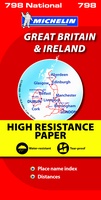 Wegenkaart - landkaart 798 Great Britain & Ireland | Michelin
Scheur- en watervast! Zoals je van Michelin mag verwachten is deze kaart zeer overzichtelijk en heeft een duidelijk helder kaartbeeld. De kaart geeft uitgebreid toeristische informatie weer. Met register, …
 Wandelkaart Ben Nevis | Harvey Maps
HARVEY launch innovative new series: Ultramap XT40. 16 titles featuring in Trail magazine through spring 2016. 40 years experience have gone into HARVEY's most creative new series. The Ultramap covers …
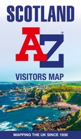 Wegenkaart - landkaart Visitors map Scotland - Schotland | A-Z Map Company
xplore the whole of Scotland from Dumfries and Galloway in the South to the Orkney Islands in the North. With detailed road mapping and illustrated town plans of major cities, …
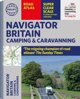 Wegenatlas Navigator Camping and Caravanning – Atlas of Britain | Philip's Maps
THE MUST-HAVE ATLAS OF BRITAIN FOR CAMPING, CARAVANNING AND MOTORHOMES'A map that beats all others' - The Daily Telegraph'Scale, accuracy and clarity are without parallel' - Driving Magazine'No. 1 in …
★★★★★ Wandelkaart The Great Trossachs Path | Harvey Maps
Een bijzonder handige kaart van dit lange-afstands-wandelpad. Op waterafstotend papier met veel details. Het enige dat je eigenlijk een beetje mist is een overzicht. Verder uitstekend en voldoende voor de …
 Wegenkaart - landkaart Pocket Map Scotland Film and TV Location Map | Collins
Full-colour, handy guide to more than 60 of the most popular film and TV locations in Scotland. Striking images and detailed descriptions allow for a comprehensive guide to Scotland's most …
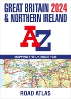 Wegenatlas Great Britain and Northern Ireland Road Atlas 2024 | A-Z Map Company
A full-colour, paperback road atlas of Great Britain, now fully revised and updated. Clear detailed road mapping at a scale of 3.5 miles to 1 inch. Presented in a large, …
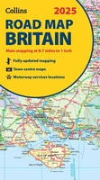 Wegenkaart - landkaart Road Map of Britain 2025 | Collins
Full-colour, double-sided road map of Great Britain at a scale of 8.7 miles to 1 inch. Northern England, Scotland and the Isle of Man are on one side with Southern …
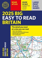 Wegenatlas Philip's Easy to Read Road Atlas of Britain 2025 | A3-Formaat | Paperback | Philip's Maps
With the detail you need at a size you can read, the latest edition of 2025 Philip's Big Easy to Read Road Atlas of Britain is super-clear, super-sized and bang …
 Spoorwegenkaart - Wegenkaart - landkaart Scotland Far North & Islands Railway & Road | ITMB
Great Britain, by its shape, is difficult to map. The population is dense, the road network intense, and the coastline convoluted. A map of the British Isles shows only the …
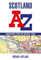 Wegenatlas Scotland - Schotland | A-Z Map Company
Handzame gedetailleerde wegenatlas van Schotland. Navigate your way around Scotland with this detailed, full-colour and easy-to-use A-Z Road Atlas. From the border to the north coast, the mainland pages scale …
★★★★★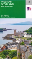 Wegenkaart - landkaart 2 OS Road Map Western Scotland & the Western Isles | Ordnance Survey
Een serie uitstekende wegenkaarten van Ordnance survey, de topografische dienst van Engeland. Alle 8 delen kennen een schaal van 1:250.000. Het kleurgebruik is uitbundig maar niet storend; integendeel, de hoogtes …
★★★★★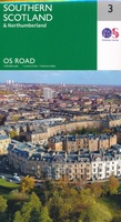 Wegenkaart - landkaart 3 OS Road Map Southern Scotland & Northumberland | Ordnance Survey
Een serie uitstekende wegenkaarten van Ordnance survey, de topografische dienst van Engeland. Alle 8 delen kennen een schaal van 1:250.000. Het kleurgebruik is uitbundig maar niet storend; integendeel, de hoogtes …
★★★★★★★★★★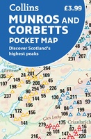 Wegenkaart - landkaart Pocket Map Munros and Corbetts | Collins
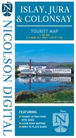 Wegenkaart - landkaart Islay, Jura & Colonsay Tourist Map | Nicolson
Nicolson Digital Tourist Maps are ideal for planning your visit to some of the most beautiful areas of Scotland. Tourist attractions and places are clearly marked. Topography is shown through …
Laatste reviews

Uitgebreide en zeer overzichtelijke kaart, bijna alles staat erop. Handig formaat en past mooi bij de aangeschafte gids.
★★★★★ door Toon Meesters 02 januari 2025 | Heeft dit artikel gekocht
Wil komende zomer naar dit schiereiland. Dit boek heeft ons nog enthousiaster gemaakt. Zeer informatief en volledig en toch in handig formaat
★★★★★ door Toon Meesters 02 januari 2025 | Heeft dit artikel gekocht
Goede omschrijving van producten, Duidelijke website en zoekmachine Snelle levering Zeer tevreden
★★★★★ door Paul Out 02 januari 2025 | Heeft dit artikel gekocht
Pakket is met de feestdagen snel en netjes verzonden. Is precies de landkaart die we zochten. Erg tevreden
★★★★★ door Marieke 01 januari 2025 | Heeft dit artikel gekocht

