South East England
 Wandelgids 084 Pathfinder Guides Berkshire, Buckinghamshire and Oxfordshire | Ordnance Survey
Wandelgids van een deel van Engeland. Deze gids bevat 28 dagwandelingen, variërend van korte tochten tot pittige dagtochten. De bijbehorende kaarten zijn uitstekend: men heeft de topografische kaarten van Ordnance …
 Wandelgids Capital Ring | Aurum Press
The Capital Ring is a 78-mile (125 km) walking route encircling inner London that links the astonishing number of islands of green space - parks, woodlands, abandoned railway lines, towpaths …
 Wandelgids 15 Short Walks in the Surrey Hills | Cicerone
Our authors have chosen 15 of the best short walks around the Surrey Hills for you to explore. Our guide comes with easy-to-read Ordnance Survey maps and clear route descriptions, …
 Wandelkaart National Trail Map South Downs Way | Collins
Overzichtskaart op vrij grove schaal van deze LAW Lange Afstands Wandeling in Engeland. Wel met veel informatie op de kaart, goed ingetekend, een route-schema op de achterzijde en een beschrijving …
 Wandelkaart National Trail Map Pennine Way | Collins
Overzichtskaart op vrij grove schaal van deze LAW Lange Afstands Wandeling in Engeland. Let op: je kunt er niet op lopen. Wel met veel informatie op de kaart, goed ingetekend, …
 Wandelkaart National Trail Map Thames Path | Collins
Overzichtskaart op vrij grove schaal van deze LAW Lange Afstands Wandeling in Engeland. Let op: je kunt er niet op lopen. Wel met veel informatie op de kaart, goed ingetekend, …
 Wandelgids 1 Via Francigena Pilgrim Route Part 1 | Cicerone
The 2000km Via Francigena from Canterbury to Rome is one of the world's great pilgrim routes, with a history spanning well over a millennium. This guide describes the first section, …
 Wandelgids Weekend Walks The Surrey Hills | Pocket Mountains
Although Surrey is not far from metropolitan London, it famously has more mature woodland than any other county in England and has long been renowned for its rolling hills and …
 Fietsgids Cycling in Surrey | Bradt Travel Guides
Bradt's new cycling guide to Surrey - part of a growing series designed for the saddle bag - offers 21 routes, each including comprehensive directions plus contextual exploration of history, …
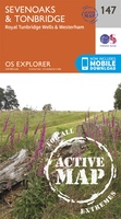 Wandelkaart - Topografische kaart 147 OS Explorer Map | Active Sevenoaks / Tonbridge | Ordnance Survey
Met zijn 4cm voor 1 km (2 ½ cm voor 1 mijl) schaal, is de OS Explorer kaartenserie de ideale en meest gedetailleerde kaartenreeks voor mensen die graag outdoor-activiteiten zoals …
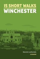 Wandelgids 15 Short Walks Winchester | Cicerone
Malcolm Leatherdale has chosen 15 of the best short walks around Winchester and central Hampshire for you to explore. Our guide comes with easy-to-read Ordnance Survey maps and clear route …
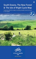 Fietskaart 04 Cycle Maps UK South Downs and The New Forest | Cordee
Een nieuwe fietskaarten serie van Groot-Brittannië. Gedrukt op scheur- en watervast papier en mooi handzaam klein formaat. Deze kaarten zijn met name heel goed om de Lange Afstands Fietsroutes (LF) …
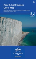 Fietskaart 05 Cycle Maps UK Kent, The High Weald and Kent Downs | Cordee
Een nieuwe fietskaarten serie van Groot-Brittannië. Gedrukt op scheur- en watervast papier en mooi handzaam klein formaat. Deze kaarten zijn met name heel goed om de Lange Afstands Fietsroutes (LF) …
 Wandelgids Day Walks on the High Weald | Vertebrate Publishing
Day Walks on the High Weald features 20 circular routes between 6.5 and 13.9 miles (10.5km and 22.4km) in length, spread across this Area of Outstanding Natural Beauty in the …
 Wandelgids Day Walks n the South Downs | Vertebrate Publishing
Day Walks on the South Downs features 20 circular routes, between 6 and 14 miles (9km and 22km) in length, suitable for hill walkers of all abilities. The routes are …
 Wandelgids the New Forest | Hallewell Publications
Walks Malham & The Three Peaks is part of a popular series of A6 pocket walking guides which describe routes which are suitable for walkers of all abilities and to …
 Wegenkaart - landkaart Engeland East Coast - Engeland Oostkust | ITMB
 Wegenkaart - landkaart Londen & Engeland Zuidoost | ITMB
 Wandelgids Chilterns | Ordnance Survey
 Stadsplattegrond Pocket Street Map Brighton | A-Z Map Company
Navigate your way around Brighton with detailed street maps from A-Z This up-to-date, folded A-Z street map includes 2,600 streets in and around Brighton. As well as the seafront and …
Laatste reviews

Heb de gids cadeau gedaan en die persoon was er heel blij mee ..
★★★★★ door J 21 november 2024 | Heeft dit artikel gekocht
De kaart van Kirgystan is prachtig, zeer gedetailleerd. Kan niet wachten tot de we echt op reis hmgaan die kant op.
★★★★★ door Marijke Eering 21 november 2024 | Heeft dit artikel gekocht
Super handig fiets boekje en mooi water bestendig. En handig om op de kaarten te kijken heel duidelijk beschrijving. Wij fietsen al jaren in Duitsland …
★★★★★ door Jenneke holterman 19 november 2024 | Heeft dit artikel gekocht
prima kaart levering en betaling allemaal vlot verlopen
★★★★★ door Marc Buts 19 november 2024 | Heeft dit artikel gekocht