Kaarten - North West England
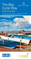 Fietskaart Cycle Map The Bay Cycle Way | Sustrans
Het is niet een heel overzichtelijke kaart, het zijn juist blokken van een deel van de route waarop deze staat ingetekend. Daarin juist wel heel goed met handige stedenkaarten en …
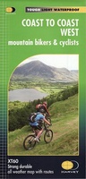 Fietskaart mountainbike Coast to Coast WEST | Harvey Maps
Deze kaart toont het westelijke deel van de route tussen St Bees/Ravenglass en Kirkby Stephen/Aysgarth via Ambleside/Windermere. Er zijn meerdere alternatieve routes ingetekend op een duidelijke topografische ondergrond. De …
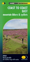 Fietskaart mountainbike Coast to Coast OOST | Harvey Maps
Deze kaart toont het oostelijke deel van de route tussen Kirkby Stephen/Aysgarth en Robin Hood's Bay/Ravenscar via Richmond/Osmotherley. Er zijn meerdere alternatieve routes ingetekend op een duidelijke topografische ondergrond. …
 Stadsplattegrond Popout Map Manchester | Compass Maps
Handig ( borstzak- ) formaat stadsplattegrond met voldoende detail, zodat je ook de kleinere straatjes erop aantreft. Van veel wereldsteden inmidddels leverbaar en dat is mooi, want juist in dit …
 Fietskaart The C2C Cycle Route - Coast to Coast | Footprint maps
- Britains most popular loing distance route. - New clear mapping, based on OS data,ata a scale of 1:90 000 - Waterproof paper and compact size - Excellent value for …
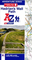 Wandelkaart Adventure Atlas Hadrian's Wall Path | A-Z Map Company
AZ heeft de meest gedetailleerde wandelkaarten van het Hadrian's Wall Path gebundeld in een atlasje. Daardoor is het heel handig qua formaat. De kaarten zelf zijn perfect voor het wandelen. …
 Wegenkaart - landkaart 3 OS Road Map Southern Scotland & Northumberland | Ordnance Survey
Een serie uitstekende wegenkaarten van Ordnance survey, de topografische dienst van Engeland. Alle 8 delen kennen een schaal van 1:250.000. Het kleurgebruik is uitbundig maar niet storend; integendeel, de hoogtes …
★★★★★★★★★★ Wegenkaart - landkaart 4 OS Road Map Northern Engeland | Ordnance Survey
Een serie uitstekende wegenkaarten van Ordnance survey, de topografische dienst van Engeland. Alle 8 delen kennen een schaal van 1:250.000. Het kleurgebruik is uitbundig maar niet storend; integendeel, de hoogtes …
★★★★★★★★★★ Wandelatlas Pennine Way Map Booklet | Cicerone
Heel handig bedacht van uitgever Cicerone: een boekje dat dienst doet als atlas met alle topografische kaarten die je nodig hebt voor het lopen van de Pennine Way. Past goed …
 Spoorwegenkaart England North and Central Rail and Road | ITMB
This is a new title for ITMB, and continues our expanded coverage of the United Kingdom. Many publishers carry a map of Great Britain (or of the UK), and a …
 Wegenkaart - landkaart Nord- und Mittelengland / Northern England & the Midlands | Reise Know-How Verlag
Hochreißfeste und 100% wasserfeste Landkarte "Nord- und Mittelengland" aus der Serie world mapping project, erschienen im Reise Know-How Verlag. Reise Know-How Landkarten zeichnen sich durch besonders stabiles Kunststoffpapier aus, …
 Fietskaart Reivers Cycle Routes | Northern Heritage Services
The long-distance Reivers Cycle Routes are two intertwining signed / waymarked bi-directional ‘coast to coast’ cycle routes between the North Sea and the Irish Sea. The original Reivers Cycle …
 Wandelkaart Walking Cheshire's Sandstone Trail - 1:25,000 OS Map Book | Northern Eye Books
Large-scale Ordnance Survey maps for walking Cheshire’s Sandstone Trail in a handy pocket size book. Cheshire’s Sandstone Trail is probably the most popular middle-distance walk in Northwest England. Here, …
 Wegenatlas Local Explorer Street Atlas Cheshire | Philip's Maps
Who hasn't explored and enjoyed their surrounding area recently and come to appreciate what is on our respective doorsteps? Philip's have created this new series for walkers, cyclists and local …
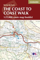 Wandelkaart The Coast to Coast Map Booklet | Cicerone
All the mapping you need to complete the 185-mile (296km) unwaymarked Coast to Coast Walk from St Bees in Cumbria to Robin Hood's Bay, North Yorkshire. This booklet of …
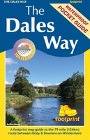 Wandelkaart The Dales Way | Footprint maps
Handzame wandelkaart voor de Dales Way in Noord Engeland. The Dales Way is a 79 mile (127km) long distance trail in the north of England, running between Ilkley, in North …
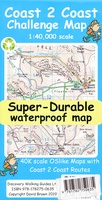 Wandelkaart Coast 2 Coast | Discovery Walking Guides
Goede scheur- en watervaste wandelkaart. The whole Coast 2 Coast on one double sided, 960mm by 694mm, map sheet. All 193 miles (308 kilometres) of the Wainwright route along with …
★★★★★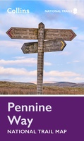 Wandelkaart National Trail Map Pennine Way | Collins
Overzichtskaart op vrij grove schaal van deze LAW Lange Afstands Wandeling in Engeland. Let op: je kunt er niet op lopen. Wel met veel informatie op de kaart, goed ingetekend, …
 Stadsplattegrond Pocket Street Map Chester | A-Z Map Company
Navigate your way around Leeds with detailed street maps from A-Z This up-to-date, folded A-Z street map includes all of the 2,100 streets in and around Blackpool. As well as …
 Stadsplattegrond Pocket Street Map Blackpool | A-Z Map Company
Navigate your way around Blackpool with detailed street maps from A-Z. This up-to-date, folded A-Z street map includes all of the 2,100 streets in and around Blackpool. As well as …
Laatste reviews

Heb de gids cadeau gedaan en die persoon was er heel blij mee ..
★★★★★ door J 21 november 2024 | Heeft dit artikel gekocht
De kaart van Kirgystan is prachtig, zeer gedetailleerd. Kan niet wachten tot de we echt op reis hmgaan die kant op.
★★★★★ door Marijke Eering 21 november 2024 | Heeft dit artikel gekocht
Super handig fiets boekje en mooi water bestendig. En handig om op de kaarten te kijken heel duidelijk beschrijving. Wij fietsen al jaren in Duitsland …
★★★★★ door Jenneke holterman 19 november 2024 | Heeft dit artikel gekocht
prima kaart levering en betaling allemaal vlot verlopen
★★★★★ door Marc Buts 19 november 2024 | Heeft dit artikel gekocht