North East England
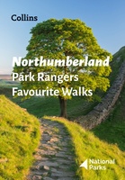 Wandelgids Park Rangers Favourite Walks Northumberland | Collins
The perfect companions for exploring the National Parks. Walking guide to the Northumberland National Park, with 20 best routes chosen by the park rangers. Each walk varies in length from …
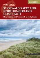 Wandelgids St Oswald's Way and Northumberland Coast Path | Cicerone
This guidebook describes the St Oswald's Way and Northumberland Coast Paths, both long-distance trails through Northumberland. St Oswald's Way (156km, 97 miles) begins in Heavenfield and traverses parts of Northumberland …
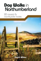 Wandelgids Day Walks in Northumberland | Vertebrate Publishing
Day Walks in Northumberlandfeatures 20 routes between 7.6 and 14.5 miles (12.2km and 23.3km) in length, spread across the coast and the countryside of Northumberland and suitable for hillwalkers of …
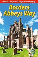 Wandelgids Borders Abbeys Way | Rucksack Readers
The Borders Abbeys Way is one of Scotland's Great Trails, a fascinating circuit that takes in the historic ruined abbeys of Melrose, Dryburgh, Kelso and Jedburgh. Within its 68 miles …
 Wandelgids Forth to Farne Way | Rucksack Readers
This inspiring 70-mile pilgrim route starts from North Berwick on the Firth of Forth near Edinburgh, and continues via Whitekirk's 12th century church to Dunbar. It follows the North Sea …
 Wandelatlas Hadrian's Wall Path Map Booklet | Cicerone
All the mapping you need to walk the 84 mile (135km) Hadrian's Wall Path from Bowness-on-Solway in Cumbria to Wallsend, Newcastle. This booklet of Ordnance Survey 1:25,000 Explorer maps has …
 Wandelgids St Cuthbert's Way | Birlinn
This 100k (60 mile) walk was opened in 1996 and has rapidly increased in popularity, with thousands of walkers walking all or parts of it every year. Visiting a number …
 Fietsgids The Ultimate Trans Pennine Trail Guide | Excellent Books
Gidsboek voor de Trans Pennine Trail met spiraalbinding, inclusief kaarten, hoogtegrafieken en verblijfsmogelijkheden. The Trans Pennine Trail guide book covers the hugely popular 370 miles (595km) of trail across the …
 Reisgids Slow Travel Durham | Bradt Travel Guides
Travel writer Gemma Hall explored Durham extensively by bicycle and on foot to produce this brand new title in Bradt's award-winning series of Slow travel guides to UK regions. Walkers, …
★★★★★ Wandelkaart National Trail Map Pennine Way | Collins
Overzichtskaart op vrij grove schaal van deze LAW Lange Afstands Wandeling in Engeland. Let op: je kunt er niet op lopen. Wel met veel informatie op de kaart, goed ingetekend, …
 Wandelgids 87 Pathfinder Guides Northumberland | Ordnance Survey
Pathfinder® Guide to Northumberland, featuring 28 outstanding walks designed for a range of abilities covering 180 miles of walking. Features: 28 guided walks for a range of abilities …
 Reisverhaal In mijn voetsporen | Coast to Coast-route | Sarah Meuleman
 Reisgids 111 places in Places in Newcastle That You Shouldn't Miss | Emons
Newcastle is England’s most northerly city and shares a long history with Gateshead, its neighbour on the south side of the River Tyne. The two, city and town respectively, are …
 Reisgids 111 places in Places in County Durham That You Shouldn't Miss | Emons
Step out from the shadow of Durham’s spectacular, UNESCO-listed cathedral to unveil this small, hilly city’s hidden depths – from historic hanging sites to hip, underground bars. Then explore unseen …
 Reisgids Michelin groene gids Noord-Engeland/Wales | Lannoo
 Wegenkaart - landkaart Nord- und Mittelengland / Northern England & the Midlands | Reise Know-How Verlag
Hochreißfeste und 100% wasserfeste Landkarte "Nord- und Mittelengland" aus der Serie world mapping project, erschienen im Reise Know-How Verlag. Reise Know-How Landkarten zeichnen sich durch besonders stabiles Kunststoffpapier aus, …
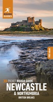 Reisgids British Breaks Newcastle and Northumbria | Rough Guides
Discover the best of Newcastle & Northumbria with this compact, practical, entertaining Pocket Rough Guide with a free eBook. This slim, trim treasure trove of trustworthy travel information is ideal …
★★★★★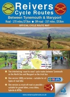 Fietskaart Reivers Cycle Routes | Northern Heritage Services
The long-distance Reivers Cycle Routes are two intertwining signed / waymarked bi-directional ‘coast to coast’ cycle routes between the North Sea and the Irish Sea. The original Reivers Cycle …
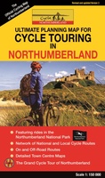 Fietskaart Cycle Touring Map of Northumberland | Northern Heritage Services
The official planner for recreational cycling and cycle touring in Northumberland and beyond. Version 3 printed 2020. Comprehensive list of promoted long distance cycle routes including: Coast and Castles …
★★★★★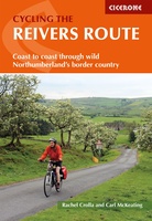 Fietsgids Cycling the Reivers Route | Cicerone
Guidebook to the Reivers Route, a 173 mile (280km) coast-to-coast cycle route across northern England and into Scotland from Tynemouth to Whitehaven. Exploring the rich history of traditional border territory, …
Laatste reviews

Zoals altijd vlekkeloos…
★★★★★ door Alex Rademacher 04 juli 2024 | Heeft dit artikel gekocht
Helemaal tevreden met het product en snel geleverd.
★★★★★ door Christoph De Windt 04 juli 2024 | Heeft dit artikel gekocht
Ideaal voor elke pelgrim die de camino loopt
★★★★★ door Saskia 03 juli 2024 | Heeft dit artikel gekocht
Goede veelomvattende kaart om de Tour de Mont Blanc te lopen. Alle varianten staan er ook op. Bruikbaar dus.
★★★★★ door Hans 03 juli 2024 | Heeft dit artikel gekocht