♦ Cotswolds AONB
 Wandelkaart - Topografische kaart OL45 OS Explorer Map The Cotswolds | Ordnance Survey
Met zijn 4cm voor 1 km (2 ½ cm voor 1 mijl) schaal, is de OS Outdoor Leisure kaartenserie de ideale en meest gedetailleerde kaartenreeks voor mensen die graag outdoor-activiteiten …
★★★★★ Reisgids The Cotswolds | Rough Guides
Zeer goede reisgids voor zowel de georganiseerde maar vooral voor de zelfstandige reiziger. Boordevol informatie over reizen, slapen, eten, maar ook musea en cultuur. Voor Europese landen meestal completer en …
★★★★★★★★★★ Wandelgids Walking in the Cotswolds | Cicerone
A guidebook to 30 circular walks in the Cotswolds, the largest Area of Outstanding Natural Beauty in England. Ranging from 4 to 12 miles in length, the routes are graded …
★★★★★ Wandelgids Heart of the Cotswolds | Rucksack Readers
“Waterproof paper, clear mapping, excellent photography and a knowledgeable text ”- Outdoor Focus The Cotswolds is the quintessential heart of England, with its rich cultural history, medieval ‘wool’ churches …
 Wandelkaart Cotswold Way | Harvey Maps
Mooie, duidelijke kaart van de Cotswold Way in Engeland. Geplastificeerd met veel extra informatie en uitsnedes van de route. A leap forward in technical excellence: Tough, durable and 100% …
★★★★★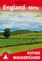 Wandelgids England Mitte - Engeland midden | Rother Bergverlag
Uitstekende wandelgids met een groot aantal dagtochten in dal en hooggebergte. Met praktische informatie en beperkt kaartmateriaal! Wandelingen in verschillende zwaarte weergegeven in rood/blauw/zwart. 184 Seiten mit 109 Farbabbildungen 52 …
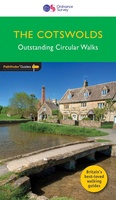 Wandelgids 006 Pathfinder Guides Cotswolds | Ordnance Survey
180 miles of wonderful walking in idyllic, limestone countryside . . . Take a journey on 28 beautiful walks across the Cotswolds with the OS Pathfinder Guidebooks, graded by …
 Wegenkaart - landkaart 6 OS Road Map Wales & West Midlands | Ordnance Survey
Een serie uitstekende wegenkaarten van Ordnance survey, de topografische dienst van Engeland. Alle 8 delen kennen een schaal van 1:250.000. Het kleurgebruik is uitbundig maar niet storend; integendeel, de hoogtes …
★★★★★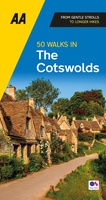 Wandelgids 50 Walks in the Cotswolds | AA Publishing
Uitstekende wandelgids met een aantal dagtochten tussen de 5 en 13 kilometer. Niet heel erg lang dus, maar wel op de mooiste plekken en goed beschreven en prima kaartmateriaal. Walking …
★★★★★ Fotoboek Cotswold Collection | Goldeneye
 Wegenkaart - landkaart The Cotswolds | Philip's Maps
A new edition of this double-sided map of the Cotswolds clearly featuring places of tourist and historic interest in an easy-to-read style of mapping, alongside six handy town centre plans. …
 Wandelgids Day Walks in the Cotswolds | Vertebrate Publishing
Day Walks in the Cotswolds features 20 circular routes, between 7.1 and 12.6 miles (11.5km and 20.2km), suitable for hillwalkers of all abilities. Split across three areas - North-East Cotswolds, …
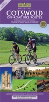
 Fietskaart 8 Tour Map The Cotswolds & Gloucestershire | Ordnance Survey
De Ordnance Survey Tour Maps met schaal 1:100.000 zijn uitstekend geschikt om zelf je fietsvakantie te plannen in Engeland. Ze laten alle alle grote en kleinere wegen zien. Bovendien staan …
★★★★★ Wandelgids Cotswold Way | Trailblazer Guides
Goede wandelgids van de hele route van Chipping Campden naar Bath. Met veel details zijn alle etappes beschreven. Tevens informatie over overnachtingen en openbaar vervoer. All-in-one hiking route guide and …
 Fietskaart Cotswold MTB map | Goldeneye
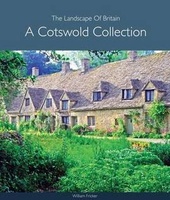 Fotoboek Cotswold Collection - The landscape of Britain | Goldeneye
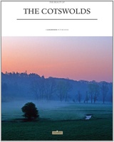 Fotoboek Cotswolds The beauty of | Goldeneye
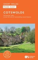 Wandelgids Cotswolds | Ordnance Survey
Explore ten easy-paced, family-friendly short walks across the Cotswolds Area of Outstanding Natural Beauty. Originating from a Saxon term meaning ‘wooded hollows, amid gentle hills’, the AONB straddles six counties, …
 Reisgids Cotswolds Top 10 | Goldeneye
 Wandelgids The Cotswolds | Pocket Mountains
Handige compacte wandelgids met 40 dagwandelingen. Deze gids bevat kleine kaartjes en leuke uitgebreide informatie over wat er langs de route te zien is. Goede wandelkaarten zijn echter we noodzakelijk …
★★★★★★★★★★
Laatste reviews

Deze waszak,opgevouwen als klein plat tasje,cadeau gegeven. De ontvanger was er superblij mee. Hij gaat binnenkort mee op een verre reis. Extra leuk dat de …
★★★★★ door Fina 30 december 2024 | Heeft dit artikel gekocht
Heel informatief
★★★★★ door Annelies 30 december 2024 | Heeft dit artikel gekocht
Zeer matige papier-kwaliteit. We hebben er alleen thuis nog op gekeken maar in de hoeken scheurt het papier al. We wandelen regelmatig hier en het …
★★★★★ door fred stassen 30 december 2024 | Heeft dit artikel gekocht
helpdesk was efficiënt en vriendelijk
★★★★★ door Sylvia 30 december 2024 | Heeft dit artikel gekocht