ITMB
ITMB International Travel Maps and Books - Wegenkaarten voor nagenoeg de hele wereld!
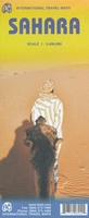 Wegenkaart - landkaart Sahara | ITMB
Een degelijke overzichtskaart met aanduidingen van o.a. nationale parken, vliegveld, benzinepomp, dirt-roads.Waterproof. Double-sided, waterproof and tear-resistant map, extending east to just beyond 25°(the border of Libya and Egypt) , and …
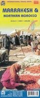 Stadsplattegrond Northern Morocco - Marokko & Marrakesh - Marrakech | ITMB
Een degelijke kaart met aanduidingen van o.a. nationale parken, vliegveld, benzinepomp, dirt-roads. The fabled city of Marrakesh (also can be spelled Marrakech), with its enormous Medina (old town) and its …
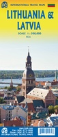 Wegenkaart - landkaart Litouwen & Letland | ITMB
ITMB is very pleased to release its first-ever map of the Baltic country of Lithuania, which occupies Side 1 of this double-sided map. It is bordered by Latvia on its …
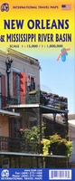 Wegenkaart - landkaart New Orleans - Mississippi River Basin | ITMB
New Orleans stadsplattegrond met schaal 1:15.000, bijzonder uitgebreid. ITMB is pleased to continue its detailed coverage of the USA with its first-ever map of the historic City of New Orleans. …
 Wegenkaart - landkaart Balkans Rail and Road | ITMB
The region of Europe known as the Balkans is normally restricted to the area that used to be Yugoslavia, but it is geographically much larger and needs to be seen …
 Wegenkaart - landkaart Ontario | ITMB
Een degelijke kaart voor Ontario met aanduidingen van o.a. nationale parken, vliegveld, benzinepomp, dirt-roads en kleine plattegrond van Toronto, Sault Ste. Marie. Als overzichtskaart goed te gebruiken. Ontario and Quebec …
★★★★★ Wegenkaart - landkaart Ierland | ITMB
As technology improves, we are able to produce more detailed maps than was previously possible. Such is the case with Ireland, a part of the world consisting of two countries …
 Stadsplattegrond Lima & Central Peru | ITMB
Peru is one of the most popular travel destinations in South America, and everyone going there arrives in Lima, which is a very large and complicated city. In this edition, …
 Wegenkaart - landkaart Philadelphia & Pennsylvania | ITMB
This map began as a result of a map conference held in Philadelphia a few years ago. Maps of the city at that time tended to concentrate on the entire …
 Wegenkaart - landkaart Vancouver Island | ITMB
Deze kaart is niet waterproof maar van gewoon papier! Prima overzichtskaart van Vancouver Island waarmee je alle activiteiten kunt plannen. Alle campsites staan vermeld, maar ook picknickspots, waar het goed …
★★★★★★★★★★ Wegenkaart - landkaart Amazon & Brazil North | ITMB
We first mapped the Amazon River Basin for a rainforest protection conference many years ago, preparing what we thought was a pretty good rendition until we arrived at a conference …
 Wegenkaart - landkaart England & Wales - Engeland | ITMB
Een degelijke kaart met aanduidingen van o.a. nationale parken, vliegveld, benzinepompen. ITMB publishes a map of Great Britain, but each portion of GB needs its own map to show roads …
 Wegenatlas Travel Atlas Polynesian Islands - Polynesië | ITMB
Wegenatlas op diverse schaal voor Polynesië. This is the only way we could think of to portray hundreds of relatively small islands efficiently. The atlas covers the Cook Islands, Easter …
 Wegenkaart - landkaart Georgia and Tbilisi - Georgië | ITMB
Georgia, the country and not the American state, is a very nice, but threatened country of great historical importance. Bordered on the west by the Black Sea, on the north …
★★★★★ Wegenkaart - landkaart Brazilië | ITMB
Een degelijke kaart met aanduidingen van o.a. nationale parken, vliegveld, benzinepomp, dirt-roads en kleine plattegrond van hoofdstad. Als overzichtskaart goed te gebruiken. Brazil, or more properly, Brasil, is a difficult …
 Wegenkaart - landkaart Mont Blanc & Alpen | ITMB
As far as mountains go, Mont Blanc in France and Italy, forming the border between the two countries, with Switzerland nearby, is the best known and most attractive mountain in …
 Wegenkaart - landkaart Northern British Columbia | ITMB
British Columbia is big! Gargantuan huge, in fact, although it is lightly populated. ITMB published a map of the more densely populated southern half of the province a number of …
 Wegenatlas Travel Atlas Japan - railway and roadatlas | ITMB
Wegenatlas in handig A5 formaat. Prettig leesbaar. Travel to Japan is growing in leaps and bounds and our basic difficulty with a map is that the country is so concentrated …
 Wegenkaart - landkaart Mexico Central | ITMB
 Wegenkaart - landkaart Mexico Yucatan Peninsula | ITMB
Een degelijke kaart met aanduidingen van o.a. nationale parken, vliegveld, benzinepomp, dirt-roads en kleine plattegrond van hoofdstad. Als overzichtskaart goed te gebruiken. This is a modest upgrading, with little …
★★★★★
Laatste reviews

Ja, ik ben heel tevreden over mijn bestelling. We zijn blij met onze reisgids, die we gekocht hebben.
★★★★★ door Trudy 04 juli 2024 | Heeft dit artikel gekocht
Zoals altijd vlekkeloos…
★★★★★ door Alex Rademacher 04 juli 2024 | Heeft dit artikel gekocht
Helemaal tevreden met het product en snel geleverd.
★★★★★ door Christoph De Windt 04 juli 2024 | Heeft dit artikel gekocht
Ideaal voor elke pelgrim die de camino loopt
★★★★★ door Saskia 03 juli 2024 | Heeft dit artikel gekocht