Kaarten
De beste wegenkaarten, routekaarten, fiets- of wandelkaarten en topografische kaarten vindt u hier!
 Fietskaart Yorkshire Dales Touring / Nidderdale Area of NB | Harvey Maps
This map provides a colourful overview of the Dales - famous Swaledale, Wensleydale, Wharfedale & Nidderdale. Colour shading makes it easy to pick out the hills & dales. Driveable roads …
 Fietskaart Yorkshire Dales for Cyclists | Harvey Maps
The area covered by this new 100% waterproof map provides fabulous opportunities from gentle routes in the valleys to some challenging climbs over the moorland that separates them. It is …
 Wandelkaart Southern Upland Way | Harvey Maps
Southern Upland Way is Britain's first official coast to coast long distance footpath and is one of Scotland's Great Trails. It runs 340km (212 miles) from Portpatrick on the south …
 Wandelkaart The Broads | Heron Maps
A full colour map of the Broads suitable for both waterways and leisure users. This map gives detailed coverage of the Broads with emphasis on the waterways and information …
 Wandelkaart Yorkshire Wolds Way | Harvey Maps
The Yorkshire Wolds Way is a 79 mile (127 km) walking route in the chalk landscape of the Yorkshire Wolds. The National Trail wends through some of the most tranquil …
 Wandelkaart Lake District Zuid Oost | Harvey Maps
Superwalker XT25 of the Lake District. Revised and re-designed. It's got everything! Genuine original HARVEY mapping at 1:25,000. Clear, easy to read. Easy to re-fold. Opens directly to either side …
 Wandelkaart Lake District Noord | Harvey Maps
New Superwalker XT25 of the Lake District. Revised and re-designed It's got everything! Genuine original HARVEY mapping at 1:25,000. Clear, easy to read. Easy to re-fold. Opens directly to either …
 Wandelkaart Ben Alder | Harvey Maps
Superwalker is designed to be the most practical tool for navigation outdoors. The Superwalker XT25 is based on original HARVEY mapping with all the information a walker would expect on …
 Wandelkaart Lake District West | Harvey Maps
New Superwalker XT25 of the Lake District Revised and re-designed. It's got everything! Genuine original HARVEY mapping at 1:25,000. Clear, easy to read. Easy to re-fold. Opens directly to either …
 Wandelkaart Peak District Noord | Harvey Maps
New, Superwalker XT25 of the Peak District. Revised and re-designed It's got everything! Genuine original HARVEY mapping at 1:25,000. Ideal for walking. Clear, easy to read. Easy to re-fold. Opens …
 Wandelkaart Skye The Cuillin | Harvey Maps
New Revised Edition and Format. More than a map, an essential piece of equipment this new generation HARVEY Superwalker is designed to be the most practical tool for navigation outdoors. …
 Wandelkaart Ben Lawers & Schiehallion | Harvey Maps
Harvey Maps for hillwalkers showing the hills from Loch Tay to Glen Lyon. This detailed walking map includes Ben Lawers and the Tarmachan Ridge. The Superwalker XT25 is based on …
 Wandelkaart Dartmoor Zuid | Harvey Maps
The whole of Dartmoor on two Maps. Dartmoor's famous Tors including Haytor Rocks and Yes Tor. The format gives more mapping on the sheet without making the map heavy and …
 Wandelkaart Dartmoor Noord | Harvey Maps
The whole of Dartmoor on two Maps. Dartmoor's famous Tors including Haytor Rocks and Yes Tor. The format gives more mapping on the sheet without making the map heavy and …
 Wandelkaart Peak District Central | Harvey Maps
New Superwalker XT25 of the Peak District Revised and re-designed. It's got everything! Genuine original HARVEY mapping at 1:25,000. Ideal for walking. Clear, easy to read. Easy to re-fold. Opens …
 Wandelkaart Arrochar Alps | Harvey Maps
Includes Beinn Ime, Ben Vorlich and the Cobbler (Ben Arthur). Detailed map for hillwalkers of the western part of the Loch Lomond and Trossachs National Park at the popular scale …
 Wandelkaart Fannichs Seana Bhraigh & Ben Wyvis | Harvey Maps
Detailed map for hillwalkers of the Fannichs ridge at the popular 1:25,000 scale. This is an area located to the south of Ullapool and to the west of Dingwall. Includes …
 Wandelkaart Yorkshire Dales Noord-Oost | Harvey Maps
The Yorkshire Dales National Park on just 4 sheets. Yorkshire Dales North East: The coverage of this map includes Swaledale, Wharfedale, Wensleydale and Nidderdale. Genuine original HARVEY mapping at 1:25,000. …
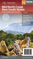
 Wegenkaart - landkaart Explorer Map Mid North Coast, New South Wales | Hema Maps
Detailkaart van een deel van Australië. Zeer goed leesbaar, met naast de topografische details veel symbolen waarmee allerhande toeristische zaken worden aangeduid als campsites, nationale parken, attracties, wandelmogelijkheden etc. A …
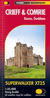
 Wandelkaart Crieff & Comrie, Doune, Dunblane | Harvey Maps
Map covers the Munro, Ben Chonzie, popular Glen Artney, as well as the Braes of Doune and Doune Castle, which has featured in various film and television shows, such as …
Laatste reviews

Prima koop
★★★★★ door Paul van Schelt 26 november 2024 | Heeft dit artikel gekocht
Het product wat ik van u heb ontvangen is prima !! maar voldoet niet geheel aan mijn verwachtingen want ik had een iets overzichtelijkere plattegrond …
★★★★★ door W. Breeschoten 26 november 2024 | Heeft dit artikel gekocht
De kaart NEPAL is netjes uitgevoerd en voldoet bijna aan mijn wensen : De plattegrond van KATHMANDU had ik liever iets uitvoeriger gezien en voorzien …
★★★★★ door Wout Breeschoten 26 november 2024 | Heeft dit artikel gekocht
Het is een mooi boekje, super handig. Beter dan de volwassen versie.
★★★★★ door Petra 26 november 2024 | Heeft dit artikel gekocht

