Wandelgidsen - ♦ Yorkshire Dales Nationaal Park
 Wandelgids The Pennine Way | Cicerone
Uitstekende wandelgids van de Pennine Way, waarbij naast alle noodzakelijke informatie ook gebruik gemaakt wordt van de echte topografische kaart. inclusief gidsje met routekaarten van 1:25000 Guidebook to the Pennine …
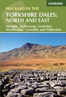 Wandelgids The Yorkshire Dales - Walking in the North and East | Cicerone
This guidebook contains 43 circular day walks in the north and east Yorkshire Dales. It explores the dales, hills and moors between Kirkby Stephen and Pateley Bridge. Walking ranges from …
 Wandelgids Coast to Coast Walk - van Ierse Zee tot Noordzee | Aurum Press
Goede gids over dit inmiddels beroemde pad. Kaartmateriaal is perfect, alsmede achtergrondinformatie. Praktische info wat minder, maar die is op de ramblerssite op internet te vinden! The Coast to Coast …
 Wandelgids 15 Pathfinder Guides Yorkshire Dales | Ordnance Survey
Wandelgids van een deel van Engeland. Deze gids bevat 28 dagwandelingen, variërend van korte tochten tot pittige dagtochten. De bijbehorende kaarten zijn uitstekend: men heeft de topografische kaarten van Ordnance …
 Wandelgids Yorkshire Wolds Way | Aurum Press
Een mooie wandelgids met een goede beschrijving en hele duidelijke kaarten met ingetekende route. The Yorkshire Wolds were brought to international attention in 2012 by David Hockney’s magnificent Royal …
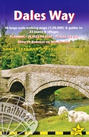 Wandelgids Dales Way | Trailblazer Guides
The popular Dales Way long-distance footpath begins in Ilkley, West Yorkshire and runs for 84 miles (135km) to end in the Lake District, in Bowness-on-Windermere. It follows riverside paths along …
 Wandelgids Nidderdale Way | Rucksack Readers
The Yorkshire Dales are famously beautiful valleys in northern England, but Nidderdale is perhaps the least known of them. Unique among the dales, this scenic valley has three large reservoirs …
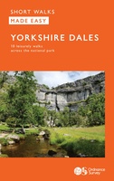 Wandelgids Yorkshire Dales | Ordnance Survey
Enjoy the magnificent waterfalls, sweeping scenery and cosy Dale pubs with ten short, leisurely walks suitable for all ages and abilities. Discover the Yorkshire Dales with its natural wonders, lush …
 Wandelgids 15 Short Walks Short Walks in Nidderdale | Cicerone
Jon Fallis has chosen 15 of the best short walks around Nidderdale in the Yorkshire Dales for you to explore. Our guide comes with easy-to-read Ordnance Survey maps and clear …
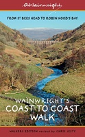 Wandelgids Wainwright's Coast to Coast Walk | Frances Lincoln
This is the first fully revised and updated edition of A. Wainwright's pocket-sized guide to the Coast to Coast Walk which he devised in the early 1970s. Over the years, …
 Wandelgids Day Walks in the Yorkshire Dales | Vertebrate Publishing
Day Walks in the Yorkshire Dales is the fourth title in Vertebrate Publishing's series of compact and portable hillwalking guidebooks. This book showcases 20 circular walks in the Yorkshire Dales …
 Wandelgids Day Walks in the South Pennines | Vertebrate Publishing
Day Walks in the South Pennines features 20 circular walks between 5 and 18 miles (8km and 29 km) in length, spread across West Yorkshire, Lancashire and Greater Manchester. Researched …
 Wandelgids Hawes and Wensleydale | Hallewell Publications
Rewalked and updated in 2016, Walks Hawes & Wensleydale covers the Northern part of the Yorkshire Dales National Park - an area of rolling green hills, dramatic limestone features and …
 Wandelgids Malham and the Three Peaks | Hallewell Publications
Last rewalked and updated in 2021, Walks Malham & The Three Peaks covers part of The Yorkshire Dales National Park - an area of rolling green hills, dramatic limestone features …
 Wandelgids Grassington and Wharfedale | Hallewell Publications
The Yorkshire Dales National Park - an area of rolling green hills, dramatic limestone features and quaint villages - has five main dales (valleys). Walks Grassington & Wharfedale covers Wharfedale …
 Wandelgids 50 Walks in the Yorkshire Dales | AA Publishing
Uitstekende wandelgids met een aantal dagtochten tussen de 5 en 15 kilometer. Niet heel erg lang dus, maar wel op de mooiste plekken en goed beschreven en prima kaartmateriaal. …
 Wandelgids The Dales Way | Cicerone
A fully waymarked trail from Ilkley to Bowness-on-Windermere, the Dales Way links two of England's most celebrated national parks, the Yorkshire Dales and the Lake District. Well served for accommodation …
★★★★★ Wandelgids Coast to Coast Path: St Bees to Robin Hood's Bay | Trailblazer Guides
Goede wandelgids van de hele route van kust naar kust. Met veel details zijn alle etappes beschreven. Tevens informatie over overnachtingen en openbaar vervoer. All the information you need to …
★★★★★ Wandelgids The Dales Way | Rucksack Readers
This charming walk runs for 79 miles (127 km) from Ilkley in the Yorkshire Dales to Bowness in the Lake District. The route heads north through Wharfedale, crisscrossing the river, …
 Wandelgids England Nord - Engeland Noord | Rother Bergverlag
Uitstekende wandelgids met 60 dagtochten. Met praktische informatie en beperkt kaartmateriaal! Wandelingen in verschillende zwaarte weergegeven in rood/blauw/zwart. Deze wandelgidsen uitgever staat hoog aangeschreven en is een begrip onder de …
Laatste reviews

Ondanks de moderne tijd met navigatie e.d. hebben we diverse reisboeken besteld. Dit is een prima keuze geweest. Het geeft veel meer rust om in …
★★★★★ door Con en Lizet Heijenrath 01 juni 2024 | Heeft dit artikel gekocht
Ondanks de moderne tijd met navigatie e.d. hebben we diverse reisboeken besteld. Dit is een prima keuze geweest. Het geeft veel meer rust om in …
★★★★★ door Con en Lizet Heijenrath 01 juni 2024 | Heeft dit artikel gekocht
Ik ben heel tevreden. Het waren de best beschikbare kaarten voor dat gebied. Met dank.
★★★★★ door Nico Kool 01 juni 2024 | Heeft dit artikel gekocht
Ik ben heel tevreden. Het waren de best beschikbare kaarten voor dat gebied. Met dank.
★★★★★ door Nico Kool 01 juni 2024 | Heeft dit artikel gekocht