Cycling guides
 Fietskaart 01 Cycling guides Cornwall | Goldeneye
Our maps are double-sided, printed on an A2 sheet with a concertina fold. This allows for easy folding and folding, and an ease of access to the mapping. The material …
 Fietskaart 02 Cycling guides Cotswolds cycling | Goldeneye
Fietskaart van Cotswold met ondermeer 28 ingetekende rondritten en veel toeristische informatie. Explore the Cotswolds by bike with this laminated, waterproof Cotswolds map. With 28 circular, clearly-marked routes this easy-to-use …
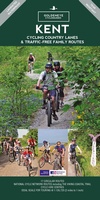
★★★★★ Fietskaart 07 Cycling guides Kent | Goldeneye
Kent is a county of great variety and it is this factor that makes it such an interesting destination for cycling. The close proximity to London and its suburbs makes …
★★★★★ Fietskaart 08 Cycling guides Lake District | Goldeneye
Scheur- en watervast foetskaart van het Lake District met ingetekende fietsroutes. Our maps are double-sided, printed on an A2 sheet with a concertina fold. This allows for easy folding and …
 Fietskaart 09 Cycling guides Norfolk | Goldeneye
Norfolk is the fourth largest county in England and one of the most rural. It is also one of the flattest and our circular routes have been chosen to explore …
 Fietskaart 10 Cycling guides North York Moors | Goldeneye
Scheur- en watervast foetskaart van de North York Moors met ingetekende fietsroutes. Our maps are double-sided, printed on an A2 sheet with a concertina fold. This allows for easy …
 Fietskaart 14 Cycling guides Suffolk | Goldeneye
To be confronted with the variety and complexity of the cycling routes, trails and paths in Suffolk can be a bewildering experience. For it appears that the Suffolk County Council …
 Fietskaart Cycling guides Exmoor - North Devon | Goldeneye
Scheur- en watervast foetskaart van Exmoor en Noord Devon met ingetekende fietsroutes. Our maps are double-sided, printed on an A2 sheet with a concertina fold. This allows for easy …
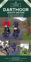
 Fietskaart Cycling guides Dartmoor - South Devon | Goldeneye
Dartmoor. One of England’s greater National Parks; the Forest of Dartmoor covers 365 square miles and contains the highest ground in England south of the Peak District. On its desolate …
Laatste reviews

De landkaart voldoet geheel aan mijn wensen. Ik zocht en zo klein mogelijke schaal, om onze routes te plannen. Helaas is de eerste bestelling verdwenen …
★★★★★ door Albert Huizing 04 januari 2025 | Heeft dit artikel gekocht
Prachtige foto’s die herkenbaar zijn na een bezoek aan Suriname. Interessante achtergrond informatie. Jammer dat het boek niet meer gedrukt wordt. Snel verstuurd!
★★★★★ door Neeltje 03 januari 2025 | Heeft dit artikel gekocht
Ik kocht dit boek voor pakjesavond voor mijn zwager en schoonzus, die het heerlijk vinden om regelmatig samen te wandelen, ergens in Nederland. Ook houden …
★★★★★ door Cindy de Lange-Wirds 03 januari 2025 | Heeft dit artikel gekocht
O.a. en kaart van Curaçao besteld. Prachtig van kwaliteit maar wel wat jammer dat de uitvoering wat gedateerd is. Reisgids is prima, evenals het fietsboekje …
★★★★★ door Henk van den Born 03 januari 2025 | Heeft dit artikel gekocht

