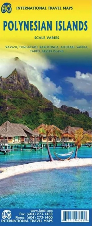
Wegenkaart - landkaart Polynesische eilanden | ITMB (9781771296311)
- ISBN / CODE: 9781771296311
- Editie: 01-12-2023
- Druk: 1
- Aantal blz.: 1
- Schaal: 1:100000
- Uitgever: ITMB
- Soort: Wegenkaart
- Taal: Engels
- Hoogte: 25.0 cm
- Breedte: 10.0 cm
- Gewicht: 56.0 g
- Uitvoering: Papier
- Bindwijze: -
- Schrijf als eerste een review
-
€ 13,95
Leverbaar in 3 - 5 werkdagen in huis in Nederland Levertijd Belgie
Gratis verzending in Nederland vanaf €35,-
Beschrijving
Van de uitgever
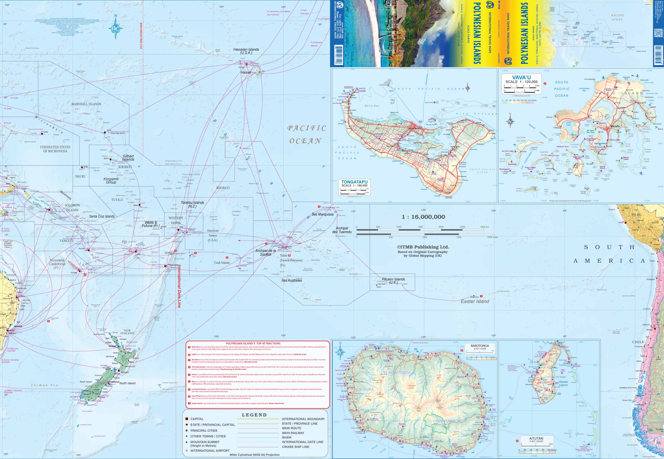
Polynesische eilanden met bootverbindingen
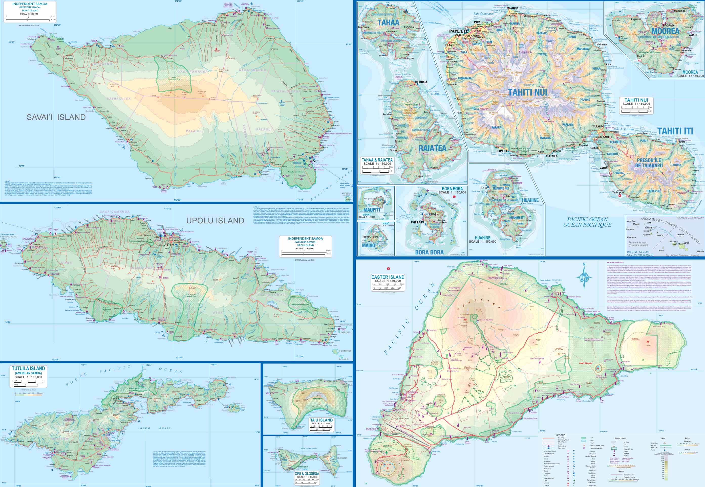
This map replaces our popular Polynesian atlas, which we have been forced to discontinue due to high printing costs. Side 1 (the cover side) has a regional map of Polynesia, from Hawaii south to New Zealand and east to Easter Island and west to the Soloman Islands. Inset maps of Aitutaki, Rarotonga, Tongatapu, and Vavau show these islands in excellent detail. The second side is loaded with inset maps of Samoa, Tahiti, Bora Bora, Easter Island, Moorea, and other lesser-known islands that constitute Polynesia. As most islands are very small, we could only focus on the larger entities, but ITMB has already prepared maps of such entities as New Caledonia, Fiji, Tonga, the Solomons, Easter Island, Samoa, and Tahiti, so this map is intended for those cruising the Pacific and visiting a variety of islands.
Legend Includes:
Roads by classification, Rivers and Lakes, National Park, Airports, Points of Interests, Highways, Main Roads, Zoos, Fishing, and much more...
Reviews
Geen reviews gevonden voor dit product.
Schrijf een review
Graag horen wij wat u van dit artikel vindt. Vindt u het goed, leuk, mooi, slecht, lelijk, onbruikbaar of erg handig: schrijf gerust alles op! Het is niet alleen leuk om te doen maar u informeert andere klanten er ook nog mee!
Ook interessant voor zuid-amerika/chili/paaseiland
-

Reisgids ANWB Wereldreisgids Chili |
€ 32,99Reisgidsen Paaseiland -

Woordenboek Phrasebook & Dictionary
€ 9,50Woordenboeken & Taalgidsen Hawaii (Staat) -

Wegenkaart - landkaart Polynesische
€ 13,95Wegenkaarten Paaseiland -

Wegenkaart - landkaart South Pacific
€ 13,95Wegenkaarten Samoa -

Reisverhaal Rapa Nui | Marijke van L
€ 17,95Reisverhalen Paaseiland