Mandje Tel: +31503126950 Menu
Winkelwagen
Geen items in winkelwagen
Ga naar winkelwagen

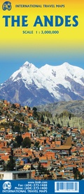
Wegenkaart - landkaart The Andes | ITMB (9781771290296)

  • ISBN / CODE: 9781771290296
  • Editie: 19-10-2022
  • Druk: 2
  • Aantal blz.: 1
  • Schaal: 1:3000000
  • Uitgever: ITMB
  • Soort: Wegenkaart
  • Taal: Engels
  • Hoogte: 25.0 cm
  • Breedte: 10.0 cm
  • Gewicht: 51.0 g
  • Bindwijze: -
  • Uitvoering: Scheur- en watervast
  • Schrijf als eerste een review
  • 13,95

    Op voorraad. Binnen 2 - 3 werkdagen in huis in Belgie Levertijd Nederland Voor 17.00 uur op werkdagen besteld, binnen 1 tot 2 werkdagen in huis in Nederland Levertijd Belgie

    Gratis verzending in Nederland vanaf €35,-

Beschrijving

Een degelijke wegenkaart van de hele Andes met aanduidingen van o.a. nationale parken, vliegveld, Als overzichtskaart goed te gebruiken.

We are pleased to be able to re-introduce this important title into our publishing range after a lapse caused by Covid. The Andes mountain chain is the southern extension of the Sierra Nevada chain through Mexico and Central America, which is, in turn the southern extension of the Rocky Mountain chain from Alaska to the Mexican border. The Andes is a magnificent series of high mountains that enters Colombia and spreads southwards through Ecuador and Peru all the way to southern Patagonia. The map is double-sided, with the Northern Andes on one side and the other side divided into two side-by-side maps portraying the Central Andes and the Southern Andes. Thus, the map coverage focuses on the Andes themselves, rather than on all of South America. All of Colombia and Peru are shown, most of Bolivia, all of Chile, and the Patagonian portion of Argentina except for the southern portion of Tierra del Fuego. The importance of this map is that it focuses on the highland areas of the continent, where much of the population lives. Bogota, Medellin, Quito, Lima, Arequipa, La Paz, Santiago, Talca, and Punta Arenas are all located along the spine of the Andes. So are the Torres del Paine peaks, the Montt Glacier, and numerous volcanoes, touristic sites, and twisting mountain roads. This is one of those maps screaming out to be done
 
Legend Includes:
Roads by classification, Rivers and Lakes, National Park, Airports, Points of Interests, Highways, Main Roads, Zoos, Fishing, and much more...


Reviews

Geen reviews gevonden voor dit product.

Schrijf een review

Graag horen wij wat u van dit artikel vindt. Vindt u het goed, leuk, mooi, slecht, lelijk, onbruikbaar of erg handig: schrijf gerust alles op! Het is niet alleen leuk om te doen maar u informeert andere klanten er ook nog mee!