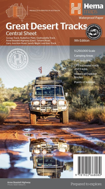
Wegenkaart - landkaart Great Desert Tracks Centraal |Australië | Hema Maps (9781922668080)
- ISBN / CODE: 9781922668080
- Editie: 15-06-2022
- Druk: 9
- Aantal blz.: 1
- Schaal: 1:1250000
- Uitgever: Hema Maps
- Soort: Wegenkaart
- Taal: Engels
- Hoogte: 25.0 cm
- Breedte: 14.0 cm
- Gewicht: 63.0 g
- Uitvoering: Scheur- en watervast
- Bindwijze: -
- Schrijf als eerste een review
-
€ 15,95
Dit artikel is (tijdelijk) niet leverbaar
Beschrijving
Van de uitgever
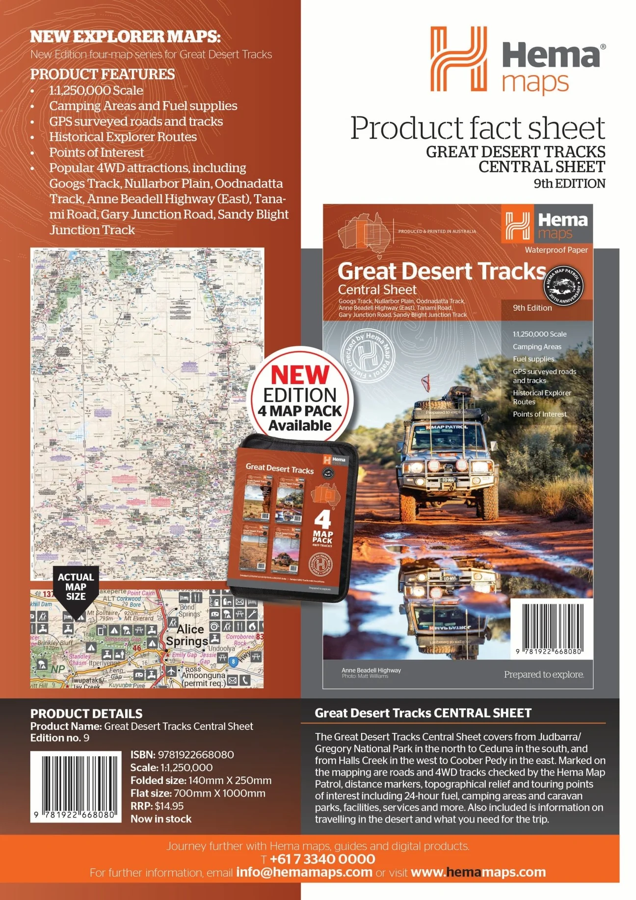
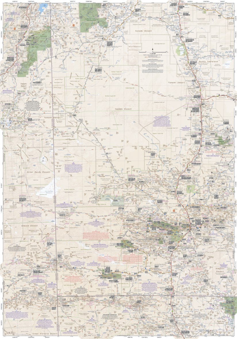
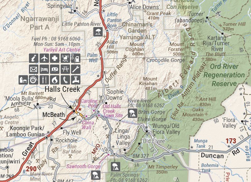
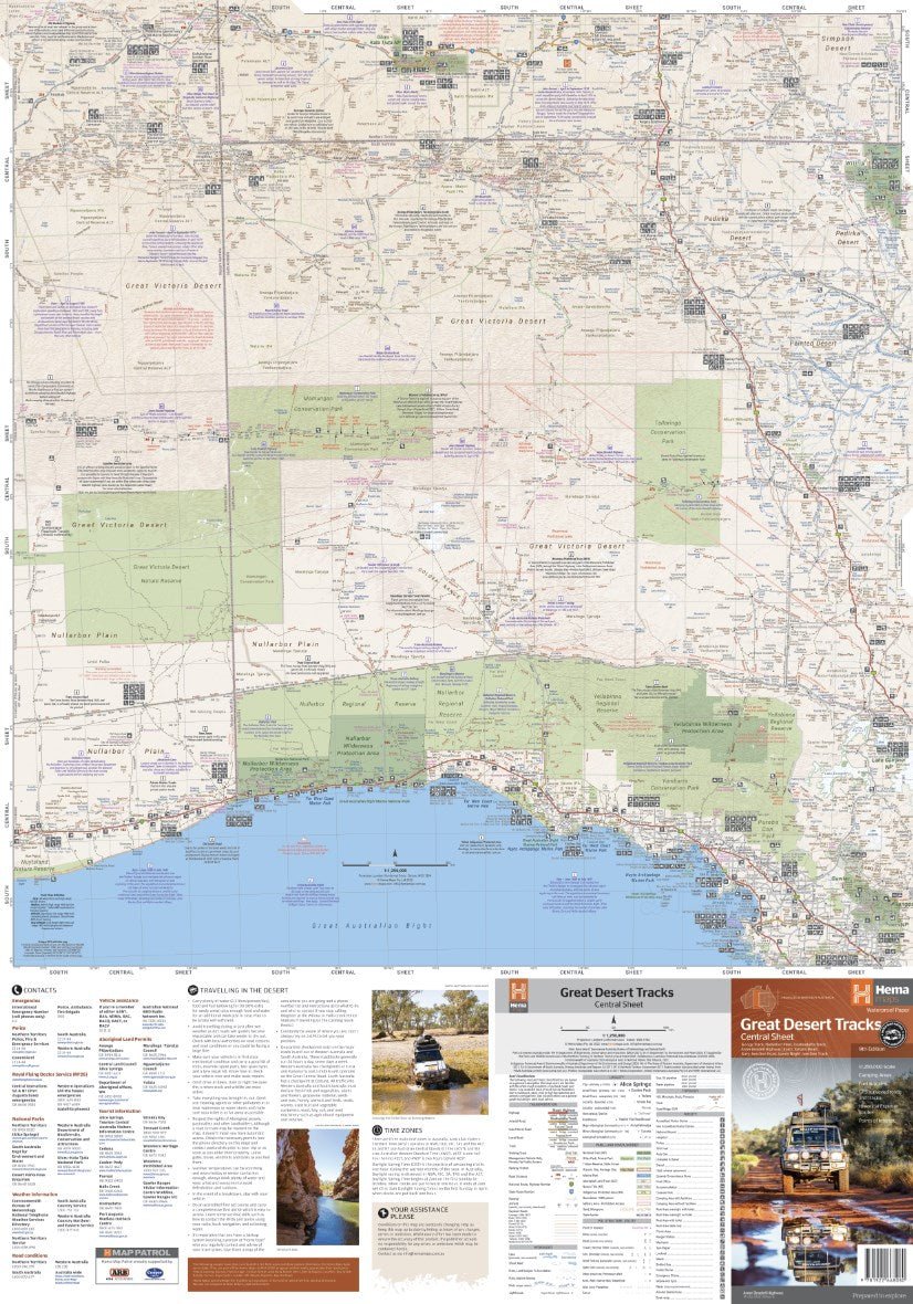
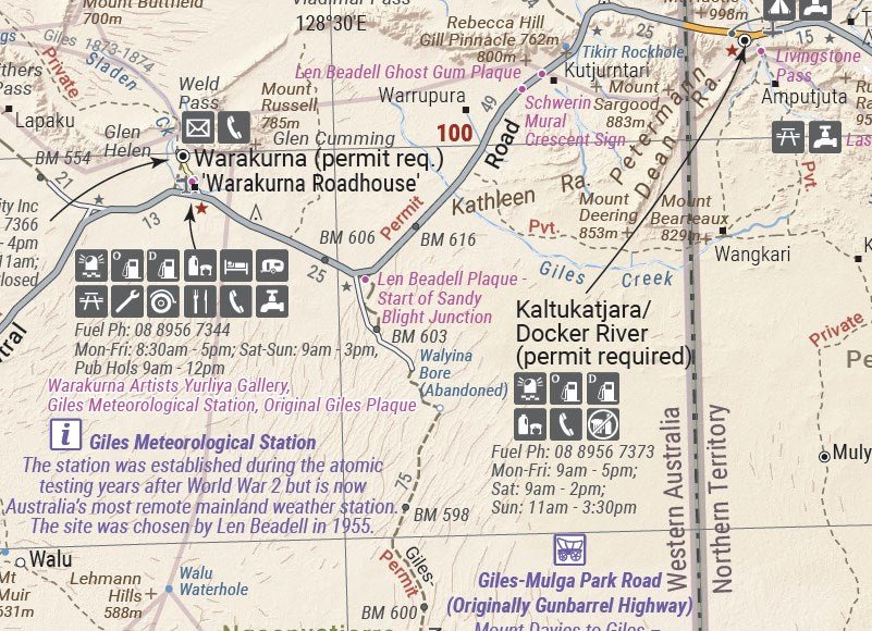
Great Desert Tracks Central Sheet (9th edition) - covering from Judbarra/Gregory National Park in the north to Ceduna in the south, and from Halls Creek in the west to Coober Pedy in the east. Marked on the mapping are roads and 4WD tracks checked by the Hema Map Patrol, distance markers, topographical relief and touring points of interest including 24-hour fuel, camping areas and caravan parks, facilities, services and more.
Hema's Great Desert Tracks maps are essential for anyone travelling in the Australian outback. The mapping features roads and 4WD tracks field-checked by the Hema Map Patrol, Points of Interest for remote area travellers and touring information for learning more about the region and planning your journey.
The Great Desert Tracks Central Sheet covers from Judbarra/Gregory National Park in the north to Ceduna in the south, and from Halls Creek in the west to Coober Pedy in the east. Marked on the mapping are roads and 4WD tracks checked by the Hema Map Patrol, distance markers, topographical relief and touring points of interest including 24-hour fuel, camping areas and caravan parks, facilities, services and more. Also included is information on travelling in the desert, what you need for the trip and relevant contact information.
Key tracks include:
- Googs Track
- Nullarbor Plain
- Oodnadatta Track
- Anne Beadell Highway (East)
- Tanami Road
- Gary Junction Road
- Sandy Blight Junction Track
KEY FEATURES:
- All maps field checked by the Hema Map Patrol
- Printed on durable, waterproof paper
- Camping areas
- Fuel supplies
- GPS surveyed roads and tracks
- Historical explorer routes
- Points of Interest
Reviews
Geen reviews gevonden voor dit product.
Schrijf een review
Graag horen wij wat u van dit artikel vindt. Vindt u het goed, leuk, mooi, slecht, lelijk, onbruikbaar of erg handig: schrijf gerust alles op! Het is niet alleen leuk om te doen maar u informeert andere klanten er ook nog mee!
Ook interessant voor oceanie/australie/westernaustraliawestaustralie
-

Reisgids Pocket Perth - Fremantle |
€ 12,95Reisgidsen Western Australia - West Australië -

Reisgids Western Australia - West Au
€ 24,95Reisgidsen Western Australia - West Australië -

Wegenkaart - landkaart Iconic Map Th
€ 15,95Wegenkaarten Northern Territories - Noord Australië -

Reisgids PassePartout Australië – Ee
€ 24,50Reisgidsen South Australia - Zuid Australië -

Wegenatlas Australië | ANWB Media
€ 15,99Wegenatlassen New South Wales Zuidoost Australië