Wegenkaart - landkaart - Stadsplattegrond Montreal & Southern Quebec | ITMB (9781771294676)
- ISBN / CODE: 9781771294676
- Editie: 01-09-2018
- Druk: 4
- Aantal blz.: 1
- Schaal: 1:12500
- Uitgever: ITMB
- Soort: Stadsplattegrond, Wegenkaart
- Taal: Engels
- Hoogte: 25.0 cm
- Breedte: 10.0 cm
- Gewicht: 96.0 g
- Uitvoering: Scheur- en watervast
- Beoordeling: 5,0 ★★★★★ (1 review) Schrijf een review
-
€ 13,95
Op voorraad. Voor 17.00 uur op werkdagen besteld, binnen 1 tot 2 werkdagen in huis in Nederland Levertijd Belgie
Gratis verzending in Nederland vanaf €35,-
Beschrijving
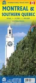
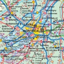
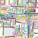
Stadsplattegrond van Montreal met register. Op de achterzijde een kaart van het zuiden van Quebec.
1:12,500/1:850,000 on waterproof paper. In this third, updated, edition of Canada's third largest city, we have added a user-friendly bonus. As is common now to most of our city maps, we have included a regional map of the hinterland of the urban area, so buyers won't have to purchase a second map to explore the environs of the city being presented. In the case of Montreal, being in a huge geographic country, this means Southern Quebec which, because of its size, dictates a map of more than one to a million scale. In the European context this would be the equivalent of Paris and all of France as a 'regional' map of the surrounds of Paris - but that's France and this is Canada.
Reviews
Ja, zeer tevreden. Prima kaart. Goed verzorgd aangekomen. Ga zo door.
★★★★★ door G. van Veggel 28 januari 2016Vond u dit een nuttige review? (login om te beoordelen)
Schrijf een review
Graag horen wij wat u van dit artikel vindt. Vindt u het goed, leuk, mooi, slecht, lelijk, onbruikbaar of erg handig: schrijf gerust alles op! Het is niet alleen leuk om te doen maar u informeert andere klanten er ook nog mee!


