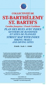
Wegenkaart - landkaart Saint-Barthélemy / St. Barth's (French Caribbean) | Kasprowski Maps (9791095793090)
- ISBN / CODE: 9791095793090
- Editie: 01-01-2013
- Aantal blz.: 1
- Schaal: 1:10000
- Uitgever: Kasprowski Maps
- Soort: Wegenkaart
- Taal: Engels
- Hoogte: 23.0 cm
- Breedte: 12.0 cm
- Gewicht: 59.0 g
- Uitvoering: Papier
- Bindwijze: -
- Schrijf als eerste een review
-
€ 16,95
Leverbaar in 3 - 5 werkdagen in huis in Nederland Levertijd Belgie
Gratis verzending in Nederland vanaf €35,-
Beschrijving
Van de uitgever
This first and only complete road and street map with a street index of St. Barth's (Scale 1 : 1 000) renders all the island's known roads and streets with their names - current names in French, historical names in Swedish, shows hiking trails and points to diving sites with their GPS coordinates.
It contains the following features:
• Attractive full color layout;
• Rich topographic detail;
• Symbol key and scale;
• Inset of capital Gustavia, main and secondary roads, diving sites, shipwrecks, hiking trails, beaches, bridges, an airport, lighthouses, reefs, geological formations, marinas, ports, ferry lines, churches, cemeteries, protected zones, moorings, gas stations, parking areas, and other points of interest;
• Depth curves, soundings in meters, longitude and latitude lines and other identifiers.
Reviews
Geen reviews gevonden voor dit product.
Schrijf een review
Graag horen wij wat u van dit artikel vindt. Vindt u het goed, leuk, mooi, slecht, lelijk, onbruikbaar of erg handig: schrijf gerust alles op! Het is niet alleen leuk om te doen maar u informeert andere klanten er ook nog mee!


