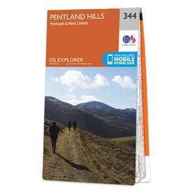
Wandelkaart - Topografische kaart 344 OS Explorer Map Pentland Hills | Ordnance Survey (9780319245965)
Penicuik & West Linton
- ISBN / CODE: 9780319245965
- Editie: 2015
- Schaal: 1:25000
- Uitgever: Ordnance Survey
- Soort: Topografische kaart, Wandelkaart
- Serie: OS Explorer Map
- Taal: Engels
- Hoogte: 23.0 cm
- Breedte: 13.0 cm
- Dikte: 1.0 cm
- Gewicht: 150.0 g
- Uitvoering: Papier
- Bindwijze: -
- Beoordeling: 5,0 ★★★★★ (2 reviews) Schrijf een review
-
€ 19,50
Dit artikel is (tijdelijk) niet leverbaar
-
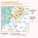
Overzichtskaart Explorer 25.000 topografische kaarten Zuid Schotland - Borders

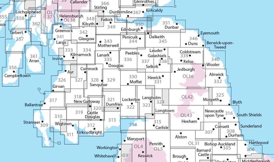
Producten op deze overzichtskaart:
Klik op een product om naar de pagina van dat product te gaan.
- Wandelkaart - Topografische kaart 307 OS Explorer Map Consett, Derwent reservoir | Ordnance Survey
- Wandelkaart - Topografische kaart 308 OS Explorer Map Durham, Sunderland | Ordnance Survey
- Wandelkaart - Topografische kaart 309 OS Explorer Map Stranraer & The Rhins | Ordnance Survey
- Wandelkaart - Topografische kaart 310 OS Explorer Map Glenluce, Kirkcowan | Ordnance Survey
- Wandelkaart - Topografische kaart 311 OS Explorer Map Wigtown, Whithorn, The Machars | Ordnance Survey
- Wandelkaart - Topografische kaart 312 OS Explorer Map Kirkcudbright, Castle Douglas | Ordnance Survey
- Wandelkaart - Topografische kaart 313 OS Explorer Map Dumfries, Dalbeattie | Ordnance Survey
- Wandelkaart - Topografische kaart 314 OS Explorer Map Solway Firth, Wigton, Silloth explorer | Ordnance Survey
- Wandelkaart - Topografische kaart 315 OS Explorer Map Carlisle, Brampton, Longtown, Gretna Green | Ordnance Survey
- Wandelkaart - Topografische kaart 316 OS Explorer Map Newcastle upon Tyne | Ordnance Survey
- Wandelkaart - Topografische kaart 317 OS Explorer Map Ballantrae, Barr & Barrhill | Ordnance Survey
- Wandelkaart - Topografische kaart 318 OS Explorer Map Galloway Forest Park North | Ordnance Survey
- Wandelkaart - Topografische kaart 319 OS Explorer Map Galloway Forest Park South | Ordnance Survey
- Wandelkaart - Topografische kaart 320 OS Explorer Map Castle Douglas, Loch Ken, New Galloway | Ordnance Survey
- Wandelkaart - Topografische kaart 321 OS Explorer Map Nithsdale, Dumfries | Ordnance Survey
- Wandelkaart - Topografische kaart 322 OS Explorer Map Annandale | Ordnance Survey
- Wandelkaart - Topografische kaart 323 OS Explorer Map Eskdale, Castle O'er Forest | Ordnance Survey
- Wandelkaart - Topografische kaart 324 OS Explorer Map Liddesdale, Kershope Forest | Ordnance Survey
- Wandelkaart - Topografische kaart 325 OS Explorer Map Morpeth, Blyth | Ordnance Survey
- Wandelkaart - Topografische kaart 326 OS Explorer Map Ayr, Troon | Ordnance Survey
- Wandelkaart - Topografische kaart 327 OS Explorer Map Cumnock, Dalmellington | Ordnance Survey
- Wandelkaart - Topografische kaart 328 OS Explorer Map Sanquhar, New Cumnock | Ordnance Survey
- Wandelkaart - Topografische kaart 329 OS Explorer Map Lowther Hills, Sanquhar, Leadhills | Ordnance Survey
- Wandelkaart - Topografische kaart 330 OS Explorer Map Moffat, St Mary's Loch | Ordnance Survey
- Wandelkaart - Topografische kaart 331 OS Explorer Map Teviotdale South | Ordnance Survey
- Wandelkaart - Topografische kaart 332 OS Explorer Map Alnwick, Amble | Ordnance Survey
- Wandelkaart - Topografische kaart 333 OS Explorer Map Kilmarnock, Irvine | Ordnance Survey
- Wandelkaart - Topografische kaart 334 OS Explorer Map East Kilbride, Galston, Darvel | Ordnance Survey
- Wandelkaart - Topografische kaart 335 OS Explorer Map Lanark, Tinto Hills | Ordnance Survey
- Wandelkaart - Topografische kaart 336 OS Explorer Map Biggar, Broughton | Ordnance Survey
- Wandelkaart - Topografische kaart 337 OS Explorer Map Peebles, Interleithen | Ordnance Survey
- Wandelkaart - Topografische kaart 338 OS Explorer Map Galashiels, Selkirk, Melrose | Ordnance Survey
- Wandelkaart - Topografische kaart 339 OS Explorer Map Kelso, Coldstream, Lower Tweed Valley | Ordnance Survey
- Wandelkaart - Topografische kaart 340 OS Explorer Map Holy Island, Bamburgh | Ordnance Survey
- Wandelkaart - Topografische kaart 341 OS Explorer Map Greenock, Largs, Millport | Ordnance Survey
- Wandelkaart - Topografische kaart 342 OS Explorer Map Glasgow | Ordnance Survey
- Wandelkaart - Topografische kaart 343 OS Explorer Map Motherwell, Coatbridge | Ordnance Survey
- Wandelkaart - Topografische kaart 344 OS Explorer Map Pentland Hills | Ordnance Survey
- Wandelkaart - Topografische kaart 345 OS Explorer Map Lammermuir Hills | Ordnance Survey
- Wandelkaart - Topografische kaart 346 OS Explorer Map Berwick-upon-Tweed | Ordnance Survey
- Wandelkaart - Topografische kaart 349 OS Explorer Map Falkirk, Cumbernauld, Livingston | Ordnance Survey
- Wandelkaart - Topografische kaart 350 OS Explorer Map Edinburgh | Ordnance Survey
- Wandelkaart - Topografische kaart 351 OS Explorer Map Dunbar, North Berwick | Ordnance Survey
- Wandelkaart - Topografische kaart 361 OS Explorer Map | Active Isle of Arran | Ordnance Survey
- Wandelkaart - Topografische kaart 362 OS Explorer Map Cowal West, Isle of Bute | Ordnance Survey
- Wandelkaart - Topografische kaart OL16 OS Explorer Map Cheviot Hills | Ordnance Survey
- Wandelkaart - Topografische kaart OL42 OS Explorer Map Kielder Water & Forest | Ordnance Survey
- Wandelkaart - Topografische kaart OL43 OS Explorer Map Hadrian's Wall | Ordnance Survey
-
Overzichtskaart Explorer 25.000 wandelkaarten Zuid Schotland - Borders

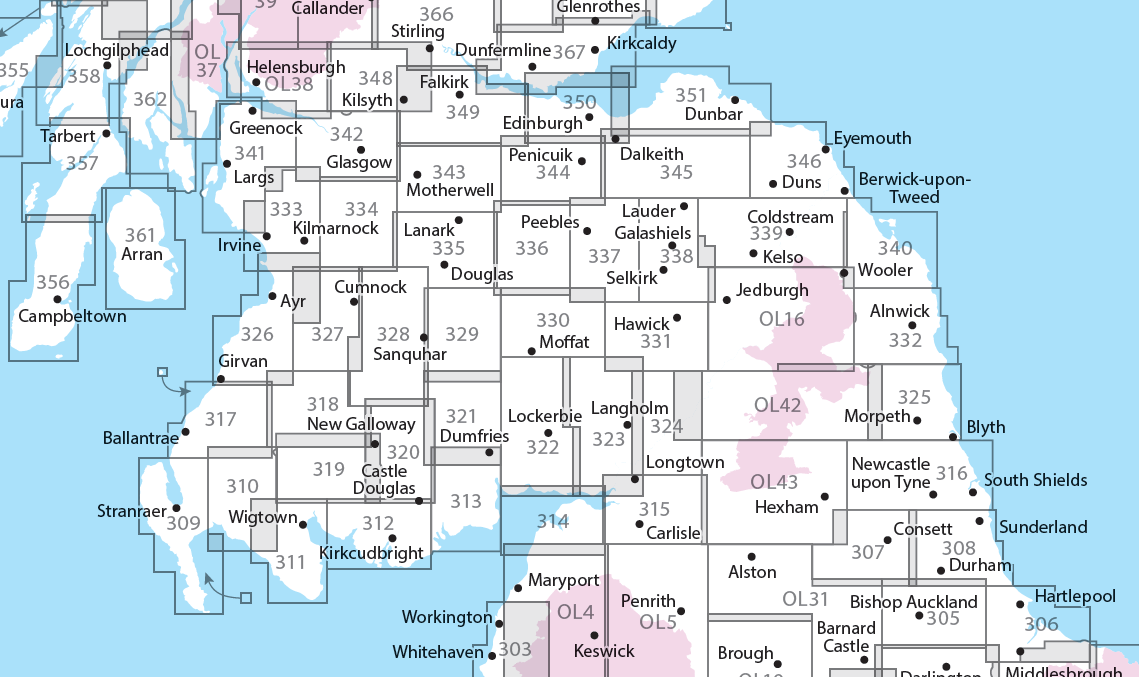
Producten op deze overzichtskaart:
Klik op een product om naar de pagina van dat product te gaan.
- Wandelkaart - Topografische kaart 307 OS Explorer Map Consett, Derwent reservoir | Ordnance Survey
- Wandelkaart - Topografische kaart 308 OS Explorer Map Durham, Sunderland | Ordnance Survey
- Wandelkaart - Topografische kaart 309 OS Explorer Map Stranraer & The Rhins | Ordnance Survey
- Wandelkaart - Topografische kaart 310 OS Explorer Map Glenluce, Kirkcowan | Ordnance Survey
- Wandelkaart - Topografische kaart 311 OS Explorer Map Wigtown, Whithorn, The Machars | Ordnance Survey
- Wandelkaart - Topografische kaart 312 OS Explorer Map Kirkcudbright, Castle Douglas | Ordnance Survey
- Wandelkaart - Topografische kaart 313 OS Explorer Map Dumfries, Dalbeattie | Ordnance Survey
- Wandelkaart - Topografische kaart 314 OS Explorer Map Solway Firth, Wigton, Silloth explorer | Ordnance Survey
- Wandelkaart - Topografische kaart 315 OS Explorer Map Carlisle, Brampton, Longtown, Gretna Green | Ordnance Survey
- Wandelkaart - Topografische kaart 316 OS Explorer Map Newcastle upon Tyne | Ordnance Survey
- Wandelkaart - Topografische kaart 317 OS Explorer Map Ballantrae, Barr & Barrhill | Ordnance Survey
- Wandelkaart - Topografische kaart 318 OS Explorer Map Galloway Forest Park North | Ordnance Survey
- Wandelkaart - Topografische kaart 319 OS Explorer Map Galloway Forest Park South | Ordnance Survey
- Wandelkaart - Topografische kaart 320 OS Explorer Map Castle Douglas, Loch Ken, New Galloway | Ordnance Survey
- Wandelkaart - Topografische kaart 321 OS Explorer Map Nithsdale, Dumfries | Ordnance Survey
- Wandelkaart - Topografische kaart 322 OS Explorer Map Annandale | Ordnance Survey
- Wandelkaart - Topografische kaart 323 OS Explorer Map Eskdale, Castle O'er Forest | Ordnance Survey
- Wandelkaart - Topografische kaart 324 OS Explorer Map Liddesdale, Kershope Forest | Ordnance Survey
- Wandelkaart - Topografische kaart 325 OS Explorer Map Morpeth, Blyth | Ordnance Survey
- Wandelkaart - Topografische kaart 326 OS Explorer Map Ayr, Troon | Ordnance Survey
- Wandelkaart - Topografische kaart 327 OS Explorer Map Cumnock, Dalmellington | Ordnance Survey
- Wandelkaart - Topografische kaart 328 OS Explorer Map Sanquhar, New Cumnock | Ordnance Survey
- Wandelkaart - Topografische kaart 329 OS Explorer Map Lowther Hills, Sanquhar, Leadhills | Ordnance Survey
- Wandelkaart - Topografische kaart 330 OS Explorer Map Moffat, St Mary's Loch | Ordnance Survey
- Wandelkaart - Topografische kaart 331 OS Explorer Map Teviotdale South | Ordnance Survey
- Wandelkaart - Topografische kaart 332 OS Explorer Map Alnwick, Amble | Ordnance Survey
- Wandelkaart - Topografische kaart 333 OS Explorer Map Kilmarnock, Irvine | Ordnance Survey
- Wandelkaart - Topografische kaart 334 OS Explorer Map East Kilbride, Galston, Darvel | Ordnance Survey
- Wandelkaart - Topografische kaart 335 OS Explorer Map Lanark, Tinto Hills | Ordnance Survey
- Wandelkaart - Topografische kaart 336 OS Explorer Map Biggar, Broughton | Ordnance Survey
- Wandelkaart - Topografische kaart 337 OS Explorer Map Peebles, Interleithen | Ordnance Survey
- Wandelkaart - Topografische kaart 338 OS Explorer Map Galashiels, Selkirk, Melrose | Ordnance Survey
- Wandelkaart - Topografische kaart 339 OS Explorer Map Kelso, Coldstream, Lower Tweed Valley | Ordnance Survey
- Wandelkaart - Topografische kaart 340 OS Explorer Map Holy Island, Bamburgh | Ordnance Survey
- Wandelkaart - Topografische kaart 341 OS Explorer Map Greenock, Largs, Millport | Ordnance Survey
- Wandelkaart - Topografische kaart 342 OS Explorer Map Glasgow | Ordnance Survey
- Wandelkaart - Topografische kaart 343 OS Explorer Map Motherwell, Coatbridge | Ordnance Survey
- Wandelkaart - Topografische kaart 344 OS Explorer Map Pentland Hills | Ordnance Survey
- Wandelkaart - Topografische kaart 345 OS Explorer Map Lammermuir Hills | Ordnance Survey
- Wandelkaart - Topografische kaart 346 OS Explorer Map Berwick-upon-Tweed | Ordnance Survey
- Wandelkaart - Topografische kaart 349 OS Explorer Map Falkirk, Cumbernauld, Livingston | Ordnance Survey
- Wandelkaart - Topografische kaart 350 OS Explorer Map Edinburgh | Ordnance Survey
- Wandelkaart - Topografische kaart 351 OS Explorer Map Dunbar, North Berwick | Ordnance Survey
- Wandelkaart 361 OS Explorer Map Isle of Arran | Ordnance Survey
- Wandelkaart - Topografische kaart 361 OS Explorer Map | Active Isle of Arran | Ordnance Survey
- Wandelkaart - Topografische kaart 362 OS Explorer Map Cowal West, Isle of Bute | Ordnance Survey
- Wandelkaart - Topografische kaart OL16 OS Explorer Map Cheviot Hills | Ordnance Survey
- Wandelkaart - Topografische kaart OL42 OS Explorer Map Kielder Water & Forest | Ordnance Survey
- Wandelkaart - Topografische kaart OL43 OS Explorer Map Hadrian's Wall | Ordnance Survey
Overzichtskaarten
Beschrijving
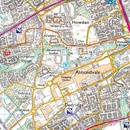
Met zijn 4cm voor 1 km (2 ½ cm voor 1 mijl) schaal, is de OS Explorer kaartenserie de ideale en meest gedetailleerde kaartenreeks voor mensen die graag outdoor-activiteiten zoals fietsen, wandelen, paardrijden, klimmen en watersporten.
Dit product heeft meerdere varianten:
Reviews
Map ordered - good price... speedy delivery. Nothing to fault.
★★★★★ door Mark Crawford 16 augustus 2024 | Heeft dit artikel gekochtVond u dit een nuttige review? (login om te beoordelen)
Correcte, snelle levering en ook nog een digitale versie meegeleverd ook!
★★★★★ door Dave Moorrees 5 mei 2016Vond u dit een nuttige review? (login om te beoordelen)
Schrijf een review
Graag horen wij wat u van dit artikel vindt. Vindt u het goed, leuk, mooi, slecht, lelijk, onbruikbaar of erg handig: schrijf gerust alles op! Het is niet alleen leuk om te doen maar u informeert andere klanten er ook nog mee!

