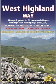
Wandelgids West Highland Way | Trailblazer Guides (9781912716296)
Milngavie to Fort William
- ISBN / CODE: 9781912716296
- Editie: 2022
- Aantal blz.: 224
- Auteur(s): Charlie Loram,Henry Stedman
- Uitgever: Trailblazer Guides
- Soort: Wandelgids
- Taal: Engels
- Hoogte: 18.0 cm
- Breedte: 12.0 cm
- Dikte: 1.4 cm
- Uitvoering: -
- Bindwijze: Paperback
- Beoordeling: 4,0 ★★★★★ (4 reviews) Schrijf een review
-
€ 19,95
Op voorraad. Voor 17.00 uur op werkdagen besteld, binnen 1 tot 2 werkdagen in huis in Nederland Levertijd Belgie
Gratis verzending in Nederland vanaf €35,-
Beschrijving
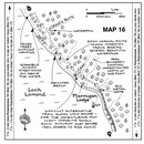
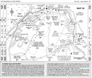
- 4 large-scale town plans, 8 overview maps and 53 large-scale walking maps, in NEW two-colour style - at just under 1:20,000 - showing route times, places to stay, places to eat, points of interest and much more. These are not general-purpose maps but fully-edited maps drawn by walkers for walkers.
- Itineraries for all walkers - whether walking the route in its entirety over a week to 10 days or sampling the highlights on day walks and short break.
- Practical information for all budgets - camping, bunkhouses, hostels, B&Bs, pubs and hotels; Glasgow through to Fort William - where to stay, where to eat, what to see, plus detailed street plans.
- Comprehensive public transport information - for all access points on the West Highland Way.
- Climb Ben Nevis - route descriptions to the top of Britain's highest mountain and other peaks.
- Flora and fauna - four page full colour flower guide, plus an illustrated section on local wildlife.
- Green hiking - understanding the local environment and minimizing our impact on it.
- Includes GPS waypoints. - also downloadable from the Trailblazer website.
- Plus extra colour sections: 16pp colour introduction and 10pp of colour mapping for stage sections (one stage per page) with trail profiles.
Reviews
Erg leuk om voor vertrek ook al eens door te bladeren, afstanden in km bij de etappes vermelden was handig geweest
★★★★★ door Tim 13 februari 2020Vond u dit een nuttige review? (login om te beoordelen)
Handige en complete gids. Getekende kaarten geven goede herkenningspunten, hoogtekaart is handig, info over accommodatie en openbaar vervoer zijn nuttig. De wandeltijden zoals vermeld slaan nergens op - deze zijn overdreven kort zelfs zonder backpack - en de afstanden corresponderen niet met kaarten van het gebied. Dit boek is handig, te gebruiken in combinatie met een trailkaart om afstanden en tijden accuraat in te kunnen schatten.
★★★★★ door Jeroen 12 september 2018Vond u dit een nuttige review? (login om te beoordelen)
Er gaat niets boven een Trailblazer boekje. Ook nu weer.
★★★★★ door Teun 30 mei 2018Vond u dit een nuttige review? (login om te beoordelen)
Schrijf een review
Graag horen wij wat u van dit artikel vindt. Vindt u het goed, leuk, mooi, slecht, lelijk, onbruikbaar of erg handig: schrijf gerust alles op! Het is niet alleen leuk om te doen maar u informeert andere klanten er ook nog mee!


