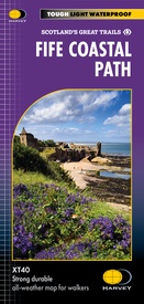
Wandelkaart Fife Coastal Path | Harvey Maps (9781851376902)
- ISBN / CODE: 9781851376902
- Editie: 01-10-2024
- Aantal blz.: 1
- Schaal: 1:40000
- Uitgever: Harvey Maps
- Soort: Wandelkaart
- Serie: National Trail Maps
- Taal: Engels
- Hoogte: 25.0 cm
- Breedte: 14.0 cm
- Gewicht: 44.0 g
- Uitvoering: Scheur- en watervast
- Bindwijze: -
- Schrijf als eerste een review
-
€ 26,95
Leverbaar in 3 - 5 werkdagen in huis in Nederland Levertijd Belgie
Gratis verzending in Nederland vanaf €35,-
-
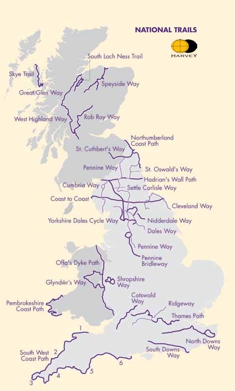
Overzicht National Trail Maps Harvey Maps


Producten op deze overzichtskaart:
Klik op een product om naar de pagina van dat product te gaan.
- Wandelkaart 1 South West Coast Path 1 | Harvey Maps
- Wandelkaart 3 South West Coast Path 3 | Harvey Maps
- Wandelkaart Affric Kintail Way | Harvey Maps
- Wandelkaart Anglesey Coastal Path | Harvey Maps
- Wandelkaart Cape Wrath Trail North | Harvey Maps
- Wandelkaart Cape Wrath Trail South | Harvey Maps
- Wandelkaart Cleveland Way | Harvey Maps
- Wandelkaart Coast to Coast | Harvey Maps
- Wandelkaart Cotswold Way | Harvey Maps
- Wandelkaart Cumbria Way | Harvey Maps
- Wandelkaart Dales Way | Harvey Maps
- Wandelkaart East Highland Way | Harvey Maps
- Wandelkaart Fife Coastal Path | Harvey Maps
- Wandelkaart Glyndwr's Way | Harvey Maps
- Wandelkaart Great Glen Way | Harvey Maps
- Wandelkaart Hadrian's Wall | Harvey Maps
- Wandelkaart John O'Groats trail | Harvey Maps
- Wandelkaart North Downs Way | Harvey Maps
- Wandelkaart Northumberland Coast Path and Berwickshire Coastal Path | Harvey Maps
- Wandelkaart Offa's Dyke Path | Harvey Maps
- Wandelkaart Peddars Way & Norfolk Coast Path | Harvey Maps
- Wandelkaart Pennine Bridleway | Harvey Maps
- Wandelkaart Pennine Way North | Harvey Maps
- Wandelkaart Pennine Way South | Harvey Maps
- Wandelkaart - Fietskaart Ridgeway | Harvey Maps
- Wandelkaart Rob Roy Way | Harvey Maps
- Wandelkaart Settle to Carlisle Way | Harvey Maps
- Wandelkaart Shropshire Way | Harvey Maps
- Wandelkaart Skye Trail | Harvey Maps
- Wandelkaart - Fietskaart South Downs Way | Harvey Maps
- Wandelkaart South Loch Ness Trail | Harvey Maps
- Wandelkaart South West Coast Path 2 | Harvey Maps
- Wandelkaart Southern Upland Way | Harvey Maps
- Wandelkaart Speyside Walk (Schotland) | Harvey Maps
- Wandelkaart St Cuthbert's Way | Harvey Maps
- Wandelkaart St Oswald's Way | Harvey Maps
- Wandelkaart Thames Path | Harvey Maps
- Wandelkaart The Great Trossachs Path | Harvey Maps
- Wandelkaart Two Moors Way | Harvey Maps
- Wandelkaart Wales Coast Path 1 | Harvey Maps
- Wandelkaart Wales Coast Path 2 | Harvey Maps
- Wandelkaart Wales Coast Path 3 | Harvey Maps
- Wandelkaart Wales Coast Path 4 | Harvey Maps
- Wandelkaart West Highland Way | Harvey Maps
Overzichtskaarten
Beschrijving
Van de uitgever
Het Fife Coastal Path biedt een gevarieerd aanbod aan landschappen, waaronder ruige kliffen, zandstranden, pittoreske vissersdorpjes en historische kastelen. Het pad biedt wandelaars de mogelijkheid om natuurreservaten te verkennen, wilde dieren te spotten en te genieten van een panoramisch uitzicht op zee. Belangrijke attracties zijn onder andere de historische universiteitsstad St. Andrews, de uitdagende ElieChainwalk en de Forth Bridges. De route is geschikt voor alle niveaus van wandelaars en is het hele jaar door toegankelijk.- Kaart toont Kincardine naar Newburgh, 187 km (116 mijl) lang, met het hele Fife Coastal Path duidelijk gemarkeerd
- Gebaseerd op originele HARVEY-kaarten met alle details die een wandelaar zou verwachten op schaal 1:40.000
- Informatie over accommodatie en diensten
- Lichtgewicht, gedetailleerd, duidelijk en gemakkelijk te lezen
- Gedrukt op stevig 100% waterbestendig, scheurvast papier
Reviews
Geen reviews gevonden voor dit product.
Schrijf een review
Graag horen wij wat u van dit artikel vindt. Vindt u het goed, leuk, mooi, slecht, lelijk, onbruikbaar of erg handig: schrijf gerust alles op! Het is niet alleen leuk om te doen maar u informeert andere klanten er ook nog mee!


