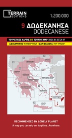
Wegenkaart - landkaart - Fietskaart 9 Touring Map Dodekanesos - Dodecanese | Terrain maps (9786185160067)
- ISBN / CODE: 9786185160067
- Editie: 01-07-2017
- Aantal blz.: 1
- Schaal: 1:200000
- Uitgever: Terrain maps
- Soort: Fietskaart, Wegenkaart
- Serie: Touring Map
- Taal: Engels
- Hoogte: 25.0 cm
- Breedte: 13.0 cm
- Gewicht: 77.0 g
- Uitvoering: Scheur- en watervast
- Schrijf als eerste een review
-
€ 13,50
Op voorraad. Voor 17.00 uur op werkdagen besteld, binnen 1 tot 2 werkdagen in huis in Nederland Levertijd Belgie
Gratis verzending in Nederland vanaf €35,-
-
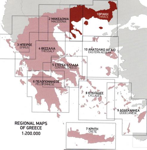
Overzicht Griekenland regionale kaarten 1:200.000 Terrain Maps


Producten op deze overzichtskaart:
Klik op een product om naar de pagina van dat product te gaan.
- Fietskaart - Wegenkaart - landkaart 1 Touring Map Thracië - Thrace en oostelijk (grieks) Macedonië - Griekenland | Terrain maps
- Fietskaart - Wegenkaart - landkaart 2 Touring Map Centraal (grieks) Macedonië | Terrain maps
- Fietskaart - Wegenkaart - landkaart 3 Touring Map Epirus en westelijk (grieks) Macedonié - Griekenland | Terrain maps
- Wegenkaart - landkaart - Fietskaart 4 Touring Map Thessaly - central Greece, centraal Griekenland | Terrain maps
- Wegenkaart - landkaart - Fietskaart 5 Touring Map Central Greece - Centraal Griekenland | Terrain maps
- Wegenkaart - landkaart - Fietskaart 6 Touring Map Peloponnese - Peloponnesos | Terrain maps
- Wegenkaart - landkaart - Fietskaart 7 Crete - Kreta | Terrain maps
- Wegenkaart - landkaart 8 Touring Map Cyclades | Terrain maps
- Wegenkaart - landkaart - Fietskaart 9 Touring Map Dodekanesos - Dodecanese | Terrain maps
Overzichtskaarten
Beschrijving
Gedetailleerde wegenkaart met toeristische informatie aangegeven. Alle tekst is tweetalig in Engels en Grieks en de waterproof kaart is geschikt voor gebruik met GPS, scheur- en watervast papier.
Reviews
Geen reviews gevonden voor dit product.
Schrijf een review
Graag horen wij wat u van dit artikel vindt. Vindt u het goed, leuk, mooi, slecht, lelijk, onbruikbaar of erg handig: schrijf gerust alles op! Het is niet alleen leuk om te doen maar u informeert andere klanten er ook nog mee!


