Wandelkaart - Topografische kaart 3538ET Aiguille de Chamberyron | IGN - Institut Géographique National (9782758550297)
Cols de Larche et de Vars
- ISBN / CODE: 9782758550297
- Editie: 15-06-2020
- Druk: 5
- Aantal blz.: 1
- Schaal: 1:25000
- Uitgever: IGN - Institut Géographique National
- Soort: Topografische kaart, Wandelkaart
- Serie: Top 25
- Taal: Frans
- Hoogte: 24.0 cm
- Breedte: 11.0 cm
- Gewicht: 92.0 g
- Uitvoering: Papier
- Bindwijze: -
- Schrijf als eerste een review
-
€ 16,95
Op voorraad. Voor 17.00 uur op werkdagen besteld, binnen 1 tot 2 werkdagen in huis in Nederland Levertijd Belgie
Gratis verzending in Nederland vanaf €35,-
-
Topografische kaarten IGN 25.000 Hautes Alpes: Ecrins

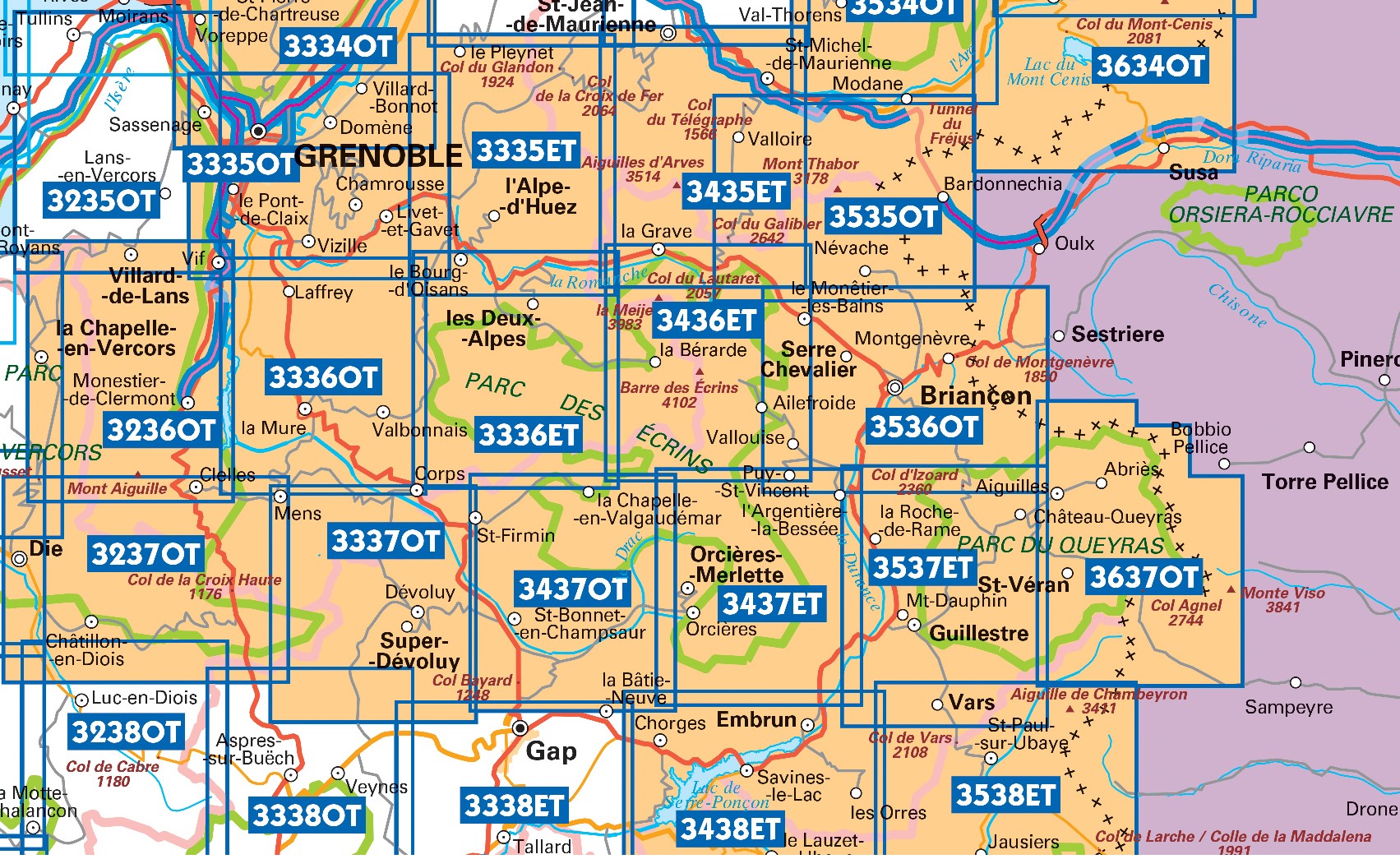
Producten op deze overzichtskaart:
Klik op een product om naar de pagina van dat product te gaan.
- Wandelkaart - Topografische kaart 3335OT Grenoble | IGN - Institut Géographique National
- Wandelkaart - Topografische kaart 3335OTR Grenoble | IGN - Institut Géographique National
- Wandelkaart - Topografische kaart 3336ET Les Deux Alpes | IGN - Institut Géographique National
- Wandelkaart - Topografische kaart 3336ETR Les Deux Alpes / Olan / Muzelle /PNR des Ecrins | IGN - Institut Géographique National
- Wandelkaart - Topografische kaart 3336OT La Mure | IGN - Institut Géographique National
- Wandelkaart - Topografische kaart 3337OT Dévoluy | IGN - Institut Géographique National
- Wandelkaart - Topografische kaart 3337OTR Dévoluy | IGN - Institut Géographique National
- Wandelkaart - Topografische kaart 3338ET Gap | IGN - Institut Géographique National
- Wandelkaart - Topografische kaart 3436ET Meije - Pelvoux | IGN - Institut Géographique National
- Wandelkaart - Topografische kaart 3437ET Orcières-Merlette | IGN - Institut Géographique National
- Wandelkaart - Topografische kaart 3437OT Champsaur | IGN - Institut Géographique National
- Wandelkaart - Topografische kaart 3438ET Embrun | IGN - Institut Géographique National
- Wandelkaart - Topografische kaart 3536OT Briançon | IGN - Institut Géographique National
- Wandelkaart - Topografische kaart 3537ET Guillestre | IGN - Institut Géographique National
- Wandelkaart - Topografische kaart 3538ET Aiguille de Chamberyron | IGN - Institut Géographique National
- Wandelkaart - Topografische kaart 3637OT Mont Viso | IGN - Institut Géographique National
-
Topografische kaarten IGN 25.000 Hautes Alpes: Queyras

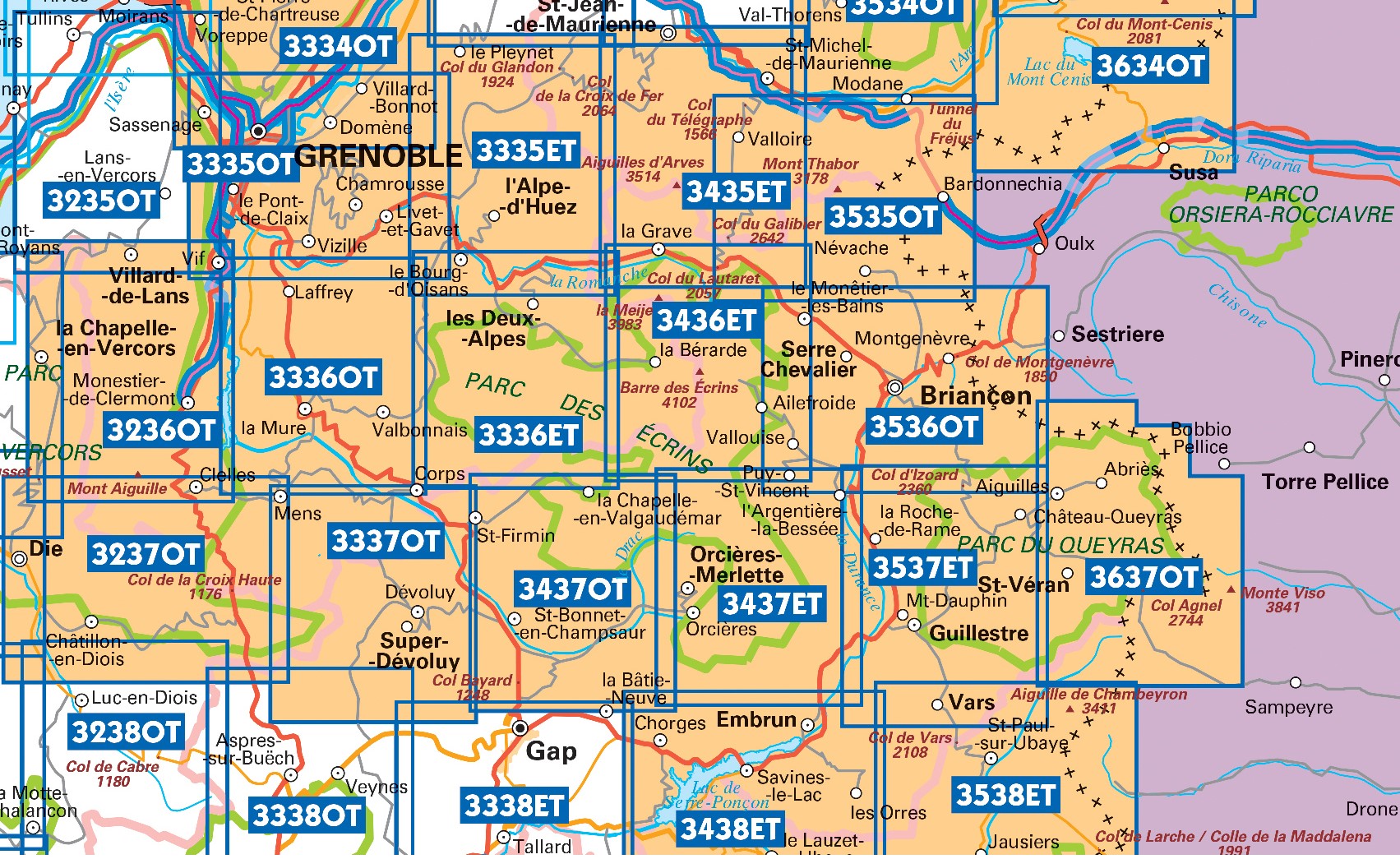
Producten op deze overzichtskaart:
Klik op een product om naar de pagina van dat product te gaan.
- Wandelkaart - Topografische kaart 3438ET Embrun | IGN - Institut Géographique National
- Wandelkaart - Topografische kaart 3536OT Briançon | IGN - Institut Géographique National
- Wandelkaart - Topografische kaart 3537ET Guillestre | IGN - Institut Géographique National
- Wandelkaart - Topografische kaart 3538ET Aiguille de Chamberyron | IGN - Institut Géographique National
- Wandelkaart - Topografische kaart 3637OT Mont Viso | IGN - Institut Géographique National
-
Wandelkaarten IGN 25.000 Hautes Alpes: Ecrins

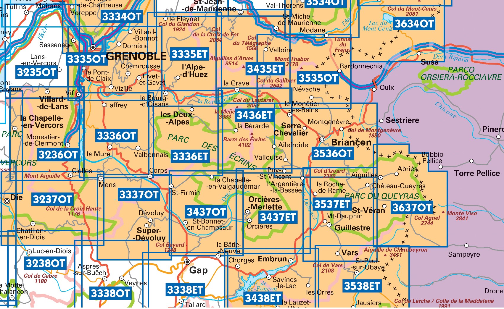
Producten op deze overzichtskaart:
Klik op een product om naar de pagina van dat product te gaan.
- Wandelkaart - Topografische kaart 3335OT Grenoble | IGN - Institut Géographique National
- Wandelkaart - Topografische kaart 3335OTR Grenoble | IGN - Institut Géographique National
- Wandelkaart - Topografische kaart 3336ET Les Deux Alpes | IGN - Institut Géographique National
- Wandelkaart - Topografische kaart 3336ETR Les Deux Alpes / Olan / Muzelle /PNR des Ecrins | IGN - Institut Géographique National
- Wandelkaart - Topografische kaart 3336OT La Mure | IGN - Institut Géographique National
- Wandelkaart - Topografische kaart 3337OT Dévoluy | IGN - Institut Géographique National
- Wandelkaart - Topografische kaart 3337OTR Dévoluy | IGN - Institut Géographique National
- Wandelkaart - Topografische kaart 3338ET Gap | IGN - Institut Géographique National
- Wandelkaart - Topografische kaart 3436ET Meije - Pelvoux | IGN - Institut Géographique National
- Wandelkaart - Topografische kaart 3437ET Orcières-Merlette | IGN - Institut Géographique National
- Wandelkaart - Topografische kaart 3437OT Champsaur | IGN - Institut Géographique National
- Wandelkaart - Topografische kaart 3438ET Embrun | IGN - Institut Géographique National
- Wandelkaart - Topografische kaart 3536OT Briançon | IGN - Institut Géographique National
- Wandelkaart - Topografische kaart 3537ET Guillestre | IGN - Institut Géographique National
- Wandelkaart - Topografische kaart 3538ET Aiguille de Chamberyron | IGN - Institut Géographique National
- Wandelkaart - Topografische kaart 3637OT Mont Viso | IGN - Institut Géographique National
-
Wandelkaarten IGN 25.000 Hautes Alpes: Queyras

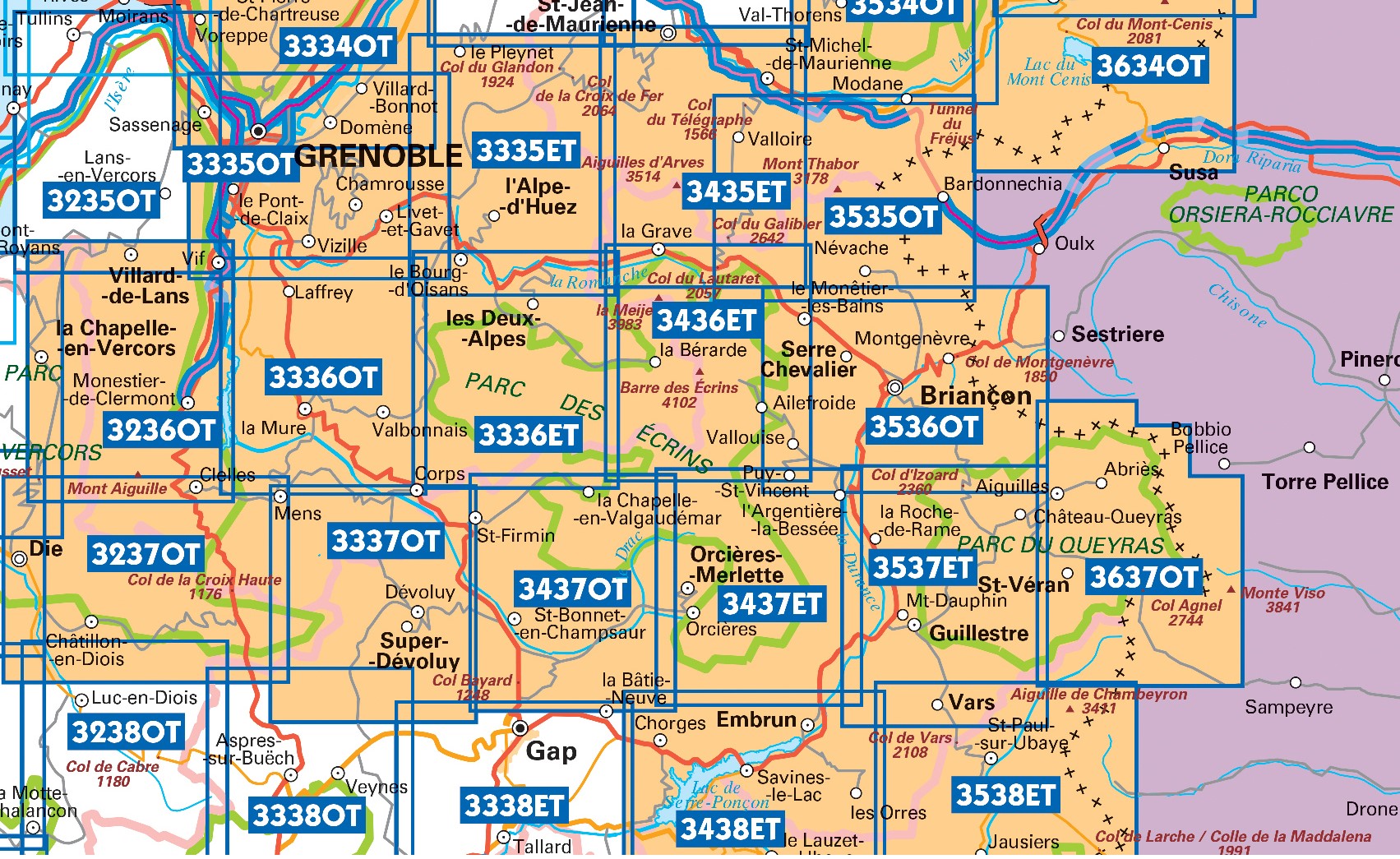
Producten op deze overzichtskaart:
Klik op een product om naar de pagina van dat product te gaan.
- Wandelkaart - Topografische kaart 3438ET Embrun | IGN - Institut Géographique National
- Wandelkaart - Topografische kaart 3536OT Briançon | IGN - Institut Géographique National
- Wandelkaart - Topografische kaart 3537ET Guillestre | IGN - Institut Géographique National
- Wandelkaart - Topografische kaart 3538ET Aiguille de Chamberyron | IGN - Institut Géographique National
- Wandelkaart - Topografische kaart 3637OT Mont Viso | IGN - Institut Géographique National
Overzichtskaarten
Beschrijving
Dit product heeft meerdere varianten:

