Topografische kaart Vätsäri Sevettijärvi Suolistaipale | Karttakeskus (9789522666390)

- ISBN / CODE: 9789522666390
- Editie: 01-06-2020
- Aantal blz.: 1
- Schaal: 1:50000
- Uitgever: Karttakeskus
- Soort: Topografische kaart
- Serie: Topographic map
- Taal: Engels, Fins
- Hoogte: 22.0 cm
- Breedte: 10.0 cm
- Gewicht: 54.0 g
- Bindwijze: -
- Uitvoering: Scheur- en watervast
- Schrijf als eerste een review
-
€ 27,95
Leverbaar in 3 - 5 werkdagen in huis in Nederland Levertijd Belgie
Gratis verzending in Nederland vanaf €35,-

-
Topografische kaarten 1/50.000 | Karttakeskus
Producten op deze overzichtskaart:
Klik op een product om naar de pagina van dat product te gaan.
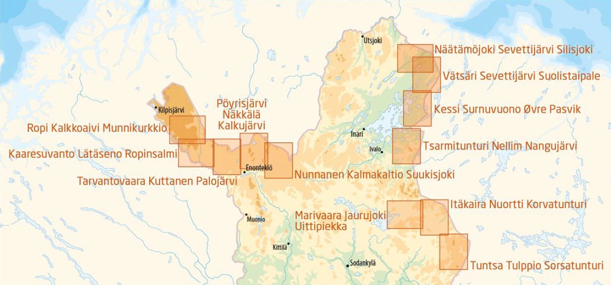
- Topografische kaart Itäkaira Kemihaara Lokka | Karttakeskus
- Topografische kaart Kaaresuvanto Lätäseno Tarvantovaara | Karttakeskus
- Wandelkaart Kuhmo Lentiira Jonkeri | Karttakeskus
- Topografische kaart Näätämöjoki Sevettijärvi Silisjoki | Karttakeskus
- Wandelkaart Pöyrisjärvi Kalmakaltio Hetta | Karttakeskus
- Topografische kaart Ropi Kalkkoaivi Munnikurkkio | Karttakeskus
- Topografische kaart Tsarmitunturi Nellim Nangujärvi | Karttakeskus
- Topografische kaart Tuntsa Tulppio Sorsatunturi | Karttakeskus
- Topografische kaart Vätsäri Sevettijärvi Suolistaipale | Karttakeskus
Overzichtskaarten
Beschrijving
Van de uitgever
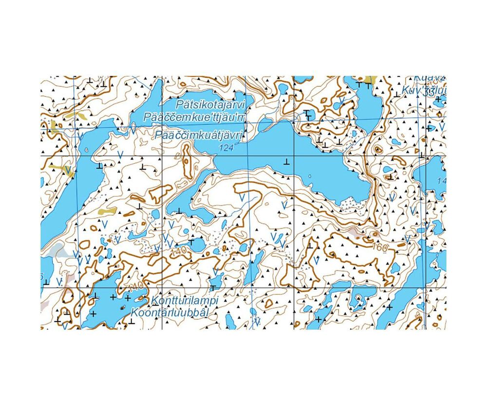
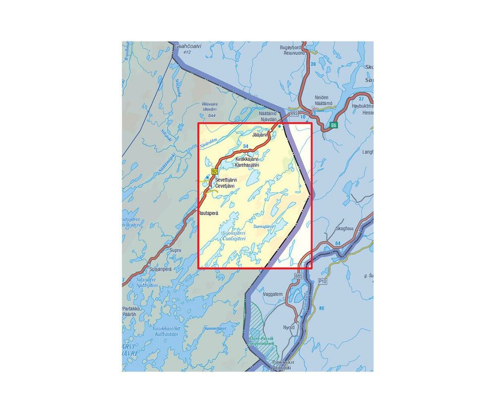
Vätsäri Wilderness and Øvre Pasvik National Park.The double-sided map sheet Vätsäri Kessi Övre Pasvik 1:50,000 covers the Vätsäri wilderness, Sevettijärvi and its surroundings, the northeastern part of Inarijärvi and Övre Pasvik National Park on the Norwegian side. Vätsäri's rocky hillside is one of the most demanding hiking areas in Finland, and thousands of clear small lakes in the Uutuanjoki watershed invite fishermen. The Piilola trail also runs through the area, and it is one of the most peaceful wilderness areas in Finland.
The Outdoor GT Series has plenty of information to offer for travellers during any season. The map focuses on cycling, paddling, hiking and snowmobile trips, so it is a useful outdoor map both in summer and in winter. For cyclists, the map has cycling routes with information on if they are paved or unpaved. Paddlers will find information on kayak and canoe trails, dangerous rapids and portage trails. To help hikers plan their journey, the map shows extensively the various marked hiking trails and wilderness huts in the area.
An Outdoor GT map is based on a road map with wetlands and contour lines (20-metre intervals) added and with plenty of travelling information. The map shows also the areas covered by the detailed outdoor maps published by Karttakeskus to help travellers find a more accurate map of their destination. On the side of the map you will find information on national cycling routes, instructions on carrying bicycles in public transports, kayak and canoe trails, hiking trails and snowmobile routes.
Reviews
Geen reviews gevonden voor dit product.
Schrijf een review
Graag horen wij wat u van dit artikel vindt. Vindt u het goed, leuk, mooi, slecht, lelijk, onbruikbaar of erg handig: schrijf gerust alles op! Het is niet alleen leuk om te doen maar u informeert andere klanten er ook nog mee!
Ook interessant voor europa/finland/fins-lapland
-

Wandelkaart Fjällkartor 1:50.000 Sal
€ 22,50Wandelkaarten Fins Lapland -

Reisgids Finnland: Saimaa und Kareli
€ 22,50Reisgidsen Finland -

Topografische kaart Vätsäri Sevettij
€ 27,95Topografische kaarten Fins Lapland -

Wandelgids Finnisch-Lappland - Finla
€ 15,50Wandelgidsen Fins Lapland -

Wegenkaart - landkaart Finland - Fin
€ 14,95Wegenkaarten Finland