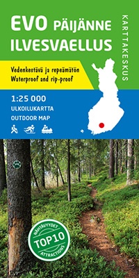
Wandelkaart Evo Päijänne ilvesvaellus | Karttakeskus (9789522663979)
- ISBN / CODE: 9789522663979
- Editie: 01-06-2017
- Aantal blz.: 1
- Schaal: 1:25000
- Uitgever: Karttakeskus
- Soort: Wandelkaart
- Serie: Outdoor map
- Taal: Engels, Fins
- Hoogte: 22.0 cm
- Breedte: 10.0 cm
- Gewicht: 52.0 g
- Uitvoering: Scheur- en watervast
- Bindwijze: -
- Schrijf als eerste een review
-
€ 22,95
Leverbaar in 3 - 5 werkdagen in huis in Nederland Levertijd Belgie
Gratis verzending in Nederland vanaf €35,-

-
Outdoor kaarten Finland | Karttakeskus
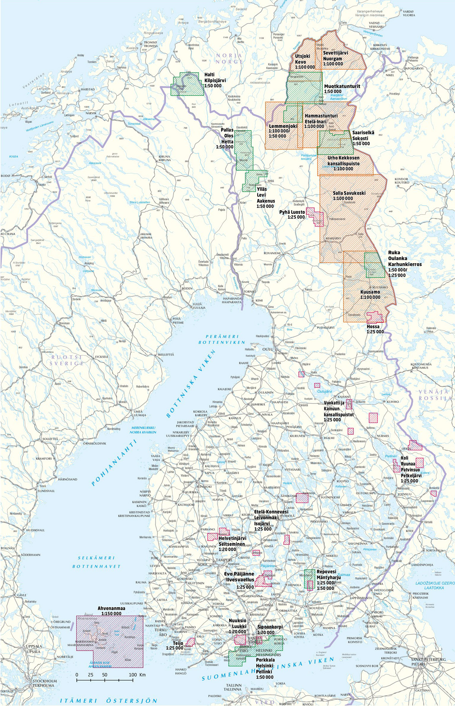
Producten op deze overzichtskaart:
Klik op een product om naar de pagina van dat product te gaan.
- Wandelkaart Etela-Konnevesi Leivonmaki | Karttakeskus
- Wandelkaart Evo Päijänne ilvesvaellus | Karttakeskus
- Wandelkaart Halti Kilpisjärvi | Karttakeskus
- Wandelkaart Hammastunturi Ivalojoki Juutua | Karttakeskus
- Wandelkaart Helvetinjärvi Seitseminen | Karttakeskus
- Wandelkaart Hossa | Karttakeskus
- Wandelkaart Kuusamo | Karttakeskus
- Wandelkaart Lemmenjoki | Karttakeskus
- Wandelkaart Nuuksio Luukki | Karttakeskus
- Wandelkaart Pallas Hetta Olos | Karttakeskus
- Wandelkaart Pyha Luosto | Karttakeskus
- Wandelkaart Repovesi Mäntyharju | Karttakeskus
- Wandelkaart Ruka Oulanka Karhunkierros | Karttakeskus
- Wegenkaart - landkaart Sevettijärvi Nuorgam | Karttakeskus
- Wandelkaart Teijo | Karttakeskus
- Wandelkaart Teijo Kurjenrahka | Karttakeskus
- Wandelkaart Utsjoki Kevo Paistunturit | Karttakeskus
- Wandelkaart Vuokatti ja Kainuun kansallispuistot | Karttakeskus
- Wandelkaart Ylläs Levi Aakenus | Karttakeskus
Overzichtskaarten
Beschrijving
Van de uitgever
The outdoor map Evo Päijänne Ilvesvaellus 1:25 000 is printed on synthetic material. The new durable Finnish outdoor maps can be identified by the yellow marking on the cover.
The region of Evo is among the most popular hiking areas in southern Finland, and it offers extensive services. Evo is also a popular place for recreational fishing. Päijänne National Park and its beautiful esker islands, on the other hand, are especially popular boating and paddling destinations. The outdoor map covers the hiking areas of Evo and Tarus, the Evo forest study areas of HAMK University of Applied Sciences, nearly all of Päijänne National Park and wide areas in their vicinity. The map shows, for instance, the Ilvesvaellus hiking trails and the connecting trails of Aurinko-Ilves and Päijänne-Ilves from Evo to Padasjoki and Vääksy.
The material of the map is fully waterproof and can withstand almost unlimited folding, and it will not rip in normal map use. The features are also retained during frost and heat. The print is crisp and the colours are bright. The map has a pleasant feel and is lighter than if printed on paper.
In addition to terrain details, e.g. routes and other hiking services, as well as dining and accommodation services, have been marked on the map. The map includes ten attractions or experiences in the area, which have been described in a few sentences at the edge of the map in Finnish and English. At the edge of the map, you can also find information about the magnetic declination. The scale of the map is 1:25 000 (1 cm on the map = 250 m of terrain).
Reviews
Geen reviews gevonden voor dit product.
Schrijf een review
Graag horen wij wat u van dit artikel vindt. Vindt u het goed, leuk, mooi, slecht, lelijk, onbruikbaar of erg handig: schrijf gerust alles op! Het is niet alleen leuk om te doen maar u informeert andere klanten er ook nog mee!
Ook interessant voor europa/finland/centraal-finland
-

Wandelkaart Hossa | Karttakeskus
€ 22,95Wandelkaarten Centraal-Finland -

Waterkaart Jyväskylä KorpilahtiVaaja
€ 29,95Waterkaarten Centraal-Finland -

Waterkaart Jämsä Luhanka Vanhanselkä
€ 29,95Waterkaarten Centraal-Finland -

Waterkaart Oravi Haukivesi Savonlinn
€ 29,95Waterkaarten Centraal-Finland -

Wandelkaart Evo Päijänne ilvesvaellu
€ 22,95Wandelkaarten Centraal-Finland