Categorieën
-
Boeken
- Aanwijswoordenboeken
- Accommodatiegidsen
- Atlassen
- Bed and Breakfast Gidsen
- Bergsporthandboeken
- Campergidsen
- Camperhandboeken
- Campinggidsen
- Duikgidsen
- Fietsatlassen
- Fietsgidsen
- Fotoboeken
- Historische Atlassen
- Kanogidsen
- Kinderatlassen
- Kinderreisgidsen
- Kleurboeken
- Klimgids - Klettersteiggidsen
- Klimgids - Klimtopo
- Kookboeken
- Mountainbikegidsen
- Natuurgidsen
- Pelgrimsroutes
- Reisboeken
- Reisdagboeken
- Reisfotografiegidsen
- Reisgidsen
- Reishandboeken
- Reisinspiratieboeken
- Reisverhalen
- Sneeuwschoenwandelgidsen
- Survivalgidsen
- Tourskigidsen
- Treinreisgidsen
- Vaargidsen
- Vogelgidsen
-
Wandelgidsen
- Afrika
- Azië
-
Europa
- Albanië
- Andorra
- Armenië
- België
- Bosnië - Hercegovina
- Bulgarije
- Cyprus
- De Alpen
- Denemarken
- Duitsland
-
Engeland
- Noord Engeland
- North East England
- ♦ Northumberland National Park
- Yorkshire and the Humber
- ♦ Yorkshire Dales Nationaal Park
- ♦ North York Moors Nationaal Park
- ■ York
- North West England
- ♦ Cumbria
- ♦ Isle of Man
- ♦ Lake District Nationaal Park
- ♦ North Pennines AONB
- ■ Liverpool
- ■ Manchester
- 🥾 Hadrian's Wall Path
- East Midlands
- West Midlands
- ♦ Peak District Nationaal Park
- ■ Birmingham
- Wales
- Swansea and the Gower
- ♦ Pembrokeshire Coast National Park
- ♦ Snowdonia Nationaal Park
- ♦ Brecon Beacons Nationaal Park
- East of England - East Anglia
- ♦ The Broads National Park
- South West England
- Cornwall
- Devon
- Dorset
- ■ Bath
- ♦ Cotswolds AONB
- ♦ Devon - Cornwall
- 🥾 South West Coast Path
- ♦ New Forrest National Park
- ♦ Exmoor National Park
- ♦ Dartmoor National Park
- ■ Bristol
- South East England
- ♦ Kent
- ♦ South Downs Nationaal Park
- ♦ Isle of Wight
- ■ Londen
- ■ Oxford
- Kanaaleilanden
- ♦ Guernsey
- ♦ Jersey
- Meer steden
- Estland
- Faroer
- Finland
- Frankrijk
- Georgië
- Griekenland
- Groenland
- Hongarije
- IJsland
- Ierland
- Italië
- Kosovo
- Kroatië
- Letland
- Liechtenstein
- Litouwen
- Luxemburg
- Malta
- Montenegro
- Nederland
- Noord-Ierland
- Noord-Macedonië
- Noorwegen
- Oostenrijk
- Polen
- Portugal
- Roemenië
- Scandinavië
- Schotland
- Servië
- Slovenië
- Slowakije
- Spanje
- Tsjechië
- Turkije
- Zweden
- Zwitserland
- Midden-Amerika
- Midden-Oosten
- Noord-Amerika
- Oceanië
- Wereld
- Zuid-Amerika
- Watersport handboeken
- Werken en wonen in buitenland
- Woordenboeken & Taalgidsen
- Kaarten
- Opruiming
- Puzzels
- Travel Gadgets
- Wandkaarten
- Wereldbollen
Veilig online betalen
Betaal veilig via uw eigen bankomgeving
- U bent hier:
- Home
- Europa
- Engeland
- ♦ Peak District Nationaal Park
- Boeken
- Wandelgidsen
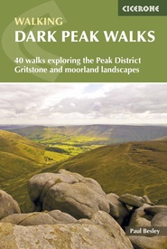
Wandelgids Dark Peak Walks | Cicerone (9781852845193)
40 walks exploring the Peak District gritstone and moorland landscapes
- ISBN / CODE: 9781852845193
- Editie: 03-03-2017
- Druk: 1
- Aantal blz.: 224
- Auteur(s): Paul Besley
- Uitgever: Cicerone
- Soort: Wandelgids
- Taal: Engels
- Hoogte: 17.0 cm
- Breedte: 12.0 cm
- Gewicht: 251.0 g
- Bindwijze: Paperback
- Uitvoering: -
- Schrijf als eerste een review
-
€ 19,95
Dit artikel is (tijdelijk) niet leverbaar Dit artikel is (tijdelijk) niet leverbaar
- Afbeeldingen
- Inkijkexemplaar
Beschrijving
Van de uitgever
Guidebook to 40 walks in the Dark Peak area of the Peak District National Park. 35 circular routes for most abilities, from 8km to 19km, around Edale, Marsden, Fairholmes, Baslow and Castleton, including Kinder Scout and Mam Tor, and 5 longer (25km to 45km) routes highlighting the best of the Gritstone Edges, High Moorland and Deep Valleys.
Seasons:
The high moorlands in winter and summer; the gritstone edges in spring and summer; the valleys in autumn; the cloughs in spring.
Centres:
Hathersage, Grindleford, Langsett, Marsden, Dove Stones, Edale, Upper Derwent Valley, Castleton, Greenfield, Chatsworth, Sheffield, Hayfield, Crowden, Hope, Dunford Bridge.
Difficulty:
Walking in the Dark Peak requires good navigational skills, especially in winter, and a good level of hillcraft. Having the correct equipment and clothing and knowing how to use it is paramount when venturing out onto the high moors.
Must See:
Kinder Scout, the highest point in the Peak District; Bleaklow, the second highest; Howden and Derwent Edges; Black Hill and the Wessenden Moors; the gritstone edges of Derwent, Bamford, Stanage, Burbage, Froggatt, Curbar, Birchen, Gardoms and the Roaches; the Eastern Moors; the Goyt Valley, Shutlingsloe and Wildboarclough.
Reviews
Geen reviews gevonden voor dit product.
Schrijf een review
Graag horen wij wat u van dit artikel vindt. Vindt u het goed, leuk, mooi, slecht, lelijk, onbruikbaar of erg handig: schrijf gerust alles op! Het is niet alleen leuk om te doen maar u informeert andere klanten er ook nog mee!
Ook interessant voor europa/engeland/peak-district-nationaal-park
-

Fietskaart 18 Cycle Maps UK Peak Dis
€ 12,95Fietskaarten West Midlands -

Wegenatlas Local Explorer Street Atl
€ 23,95Wegenatlassen East Midlands -

Wandelkaart - Topografische kaart 26
€ 19,50Topografische kaarten West Midlands -

Wandelgids 002 Pathfinder Short Walk
€ 11,95Wandelgidsen ♦ Peak District Nationaal Park -

Fietsgids Cycling in the Peak Distri
€ 18,50Fietsgidsen West Midlands


