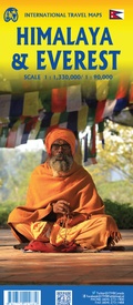
Wandelkaart Mount Everest - Himalaya | ITMB (9781771292689)
- ISBN / CODE: 9781771292689
- Editie: 30-01-2021
- Druk: 2
- Aantal blz.: 1
- Schaal: 1:90000
- Uitgever: ITMB
- Soort: Wandelkaart
- Taal: Engels
- Hoogte: 25.0 cm
- Breedte: 10.0 cm
- Gewicht: 141.0 g
- Uitvoering: Scheur- en watervast
- Schrijf als eerste een review
-
€ 13,95
Op voorraad. Voor 17.00 uur op werkdagen besteld, binnen 1 tot 2 werkdagen in huis in Nederland Levertijd Belgie
Gratis verzending in Nederland vanaf €35,-
Beschrijving
Deelkaart van het Everest gebied: niet altijd even makkelijk kleurgebruik. Op de andere kant een grove kaart van de hele Himalaya!
Roads by classification, check points, viewpoints, points of interest, camps, monasteries, lodging, stupas, airports, waterfalls, glaciers, health posts and other information.
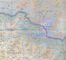
Mt Everest region at 1:90,000 from ITMB on a contoured map with tourist information but with somewhat unusual choice of colouring which makes the whole area appear more like a desert rather the highest mountain range covered in glaciers!
Coverage extends from Lukla to beyond the North Base Camp on the Tibetan side. The map has contour lines at 100m intervals, plus additional altitude colouring and graphics for glaciers, moraine, scree, rock and vegetation. Numerous mountain ranges, glaciers, peaks and passes are named.
Main Everest trekking routes are marked and symbols highlight various places of interest and tourist facilities. The map has latitude and longitude lines at intervals of 5’ and an indexed of settlements.
Reviews
Geen reviews gevonden voor dit product.
Schrijf een review
Graag horen wij wat u van dit artikel vindt. Vindt u het goed, leuk, mooi, slecht, lelijk, onbruikbaar of erg handig: schrijf gerust alles op! Het is niet alleen leuk om te doen maar u informeert andere klanten er ook nog mee!


